MyTopo
Eutawville South Carolina US Topo Map
Couldn't load pickup availability
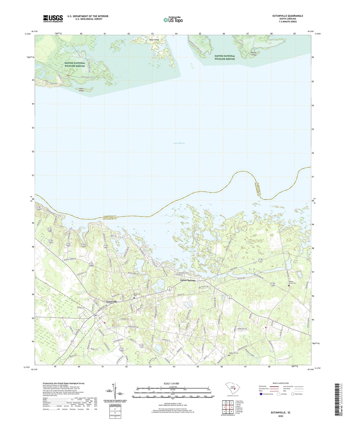
2024 topographic map quadrangle Eutawville in the state of South Carolina. Scale: 1:24000. Based on the newly updated USGS 7.5' US Topo map series, this map is in the following counties: Orangeburg, Clarendon. The map contains contour data, water features, and other items you are used to seeing on USGS maps, but also has updated roads and other features. This is the next generation of topographic maps. Printed on high-quality waterproof paper with UV fade-resistant inks.
Quads adjacent to this one:
West: Vance
Northwest: Saint Paul
North: Summerton
Northeast: Jordan
East: Eadytown
Southeast: Cross
South: Sandridge
Southwest: Holly Hill
This map covers the same area as the classic USGS quad with code o33080d3.
Contains the following named places: Black Branch School, Church of the Epiphany Episcopal Church, Colclough Pond, Cuddo Lake, Dorchee, Epiphany Church, Eutaw Creek, Eutaw Springs, Eutaw Springs Church, Eutawville, Eutawville Cemetery, Eutawville Division, Eutawville Fire Department, Eutawville Fire Department Gaillard Sub Station, Eutawville Police Department, Eutawville Post Office, Ferguson, Ferguson Landing, Fountain Lake, Gaillard School, Goodwill Church, Green Town, Little Belvidere, Mid Hill School, Mount Pisgah Church, Nelsons Ferry, Pine Island, Possum Town, Red Bank Landing, Round Island, Saint James Church, Saint James Gaillard Elementary School, Saint James School, Saint Johns Race Track, Saint Julian, Saint Julien Plantation, Savanna Branch, Silas Church, Smith Hill School, Spring Hill Church, Spring Hill School, Sullivan Lake, Tabernacle Church, Tancaw Creek, Tawcaw Creek, Town of Eutawville, Walnut Grove Cemetery, Walnut Grove Church, Walnut Grove Plantation, Walnut Grove School, Walworth Cemetery, Waner Grove School, Wutawville Deliverance Center, ZIP Code: 29048