MyTopo
Felderville South Carolina US Topo Map
Couldn't load pickup availability
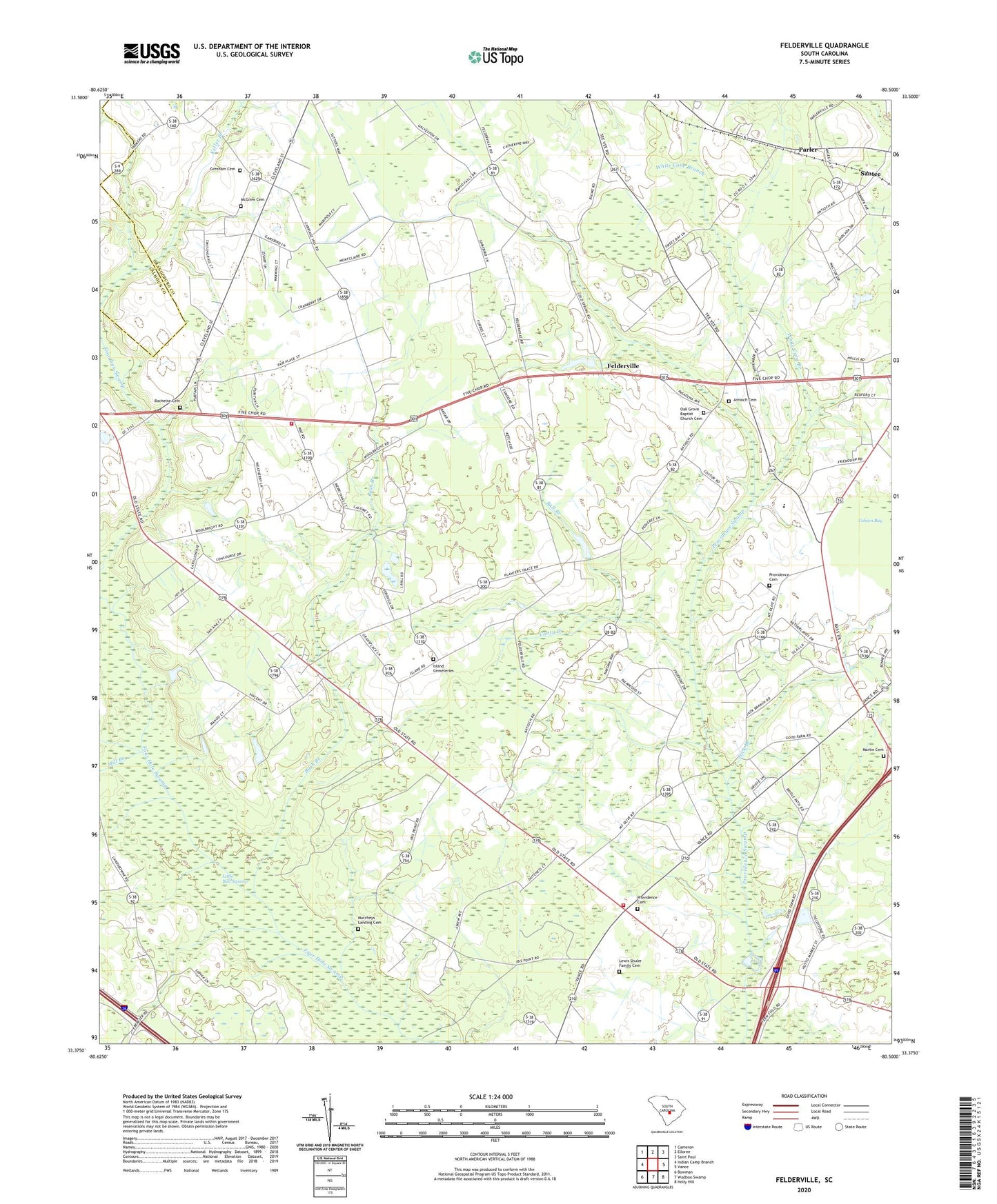
2024 topographic map quadrangle Felderville in the state of South Carolina. Scale: 1:24000. Based on the newly updated USGS 7.5' US Topo map series, this map is in the following counties: Orangeburg, Calhoun. The map contains contour data, water features, and other items you are used to seeing on USGS maps, but also has updated roads and other features. This is the next generation of topographic maps. Printed on high-quality waterproof paper with UV fade-resistant inks.
Quads adjacent to this one:
West: Indian Camp Branch
Northwest: Cameron
North: Elloree
Northeast: Saint Paul
East: Vance
Southeast: Holly Hill
South: Wadboo Swamp
Southwest: Bowman
This map covers the same area as the classic USGS quad with code o33080d5.
Contains the following named places: Antioch Cemetery, Antioch Church, Ball Branch, Bochette Cemetery, Bulls Pond Dam D-3774, Bush Branch, Candy Branch, Canty Branch, Center School, Dantzler, Dantzler Middle School, Elloree Division, Felderville, Felderville Church, Felderville School, Ferris School, Goodbys School, Goodbys Swamp, Granger Church, Granger School, Greater Friendship African Methodist Episcopal Church, Gresham Cemetery, Hickory Grove Church, Ireland School, Island Cemeteries, Island School, Jack Branch, Keller Branch, Lewis Shuler Family Cemetery, Little Bull Swamp, Martin Cemetery, McGrew Cemetery, Mill Branch, Mount Olive Church, Mount Olive School, Murcheys Landing Cemetery, North Providence School, Oak Grove Baptist Church, Oak Grove Baptist Church Cemetery, Oak Grove School, Oaks Crossroads, Parler, Providence, Providence Cemetery, Providence Church, Providence Fire Department, Providence Fire Department Station 2, Providence School, Red Hill Baptist Church, Saluda Church, South Carolina Noname 38030 D-3761 Dam, White Cane Branch, ZIP Code: 29142