MyTopo
Wadboo Swamp South Carolina US Topo Map
Couldn't load pickup availability
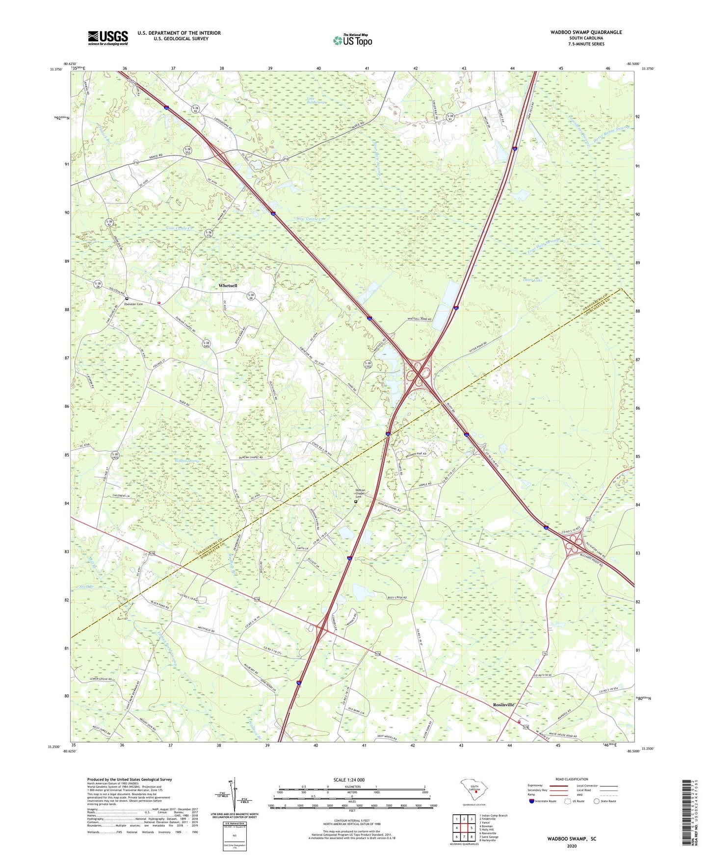
2024 topographic map quadrangle Wadboo Swamp in the state of South Carolina. Scale: 1:24000. Based on the newly updated USGS 7.5' US Topo map series, this map is in the following counties: Orangeburg, Dorchester. The map contains contour data, water features, and other items you are used to seeing on USGS maps, but also has updated roads and other features. This is the next generation of topographic maps. Printed on high-quality waterproof paper with UV fade-resistant inks.
Quads adjacent to this one:
West: Bowman
Northwest: Indian Camp Branch
North: Felderville
Northeast: Vance
East: Holly Hill
Southeast: Harleyville
South: Saint George
Southwest: Reevesville
This map covers the same area as the classic USGS quad with code o33080c5.
Contains the following named places: Bowman Fire Department Station 2, Brown School, Campmeeting Grounds, Cow Castle Creek, Dawkins Chapel, Duncan Chapel, Duncan Chapel Cemetery, Duncan School, Ebenezer Cemetery, Ebenezer Church, Enterprise School, Hill Branch School, Hill School, Horse Range Swamp, Indian Field Fire Department, Indian Field School, Jaques Dairy, Knight School, Mill Branch, Otter Lake, Patrick Branch, Providence Swamp, Rosinville, Saint Stephens Church, Shady Grove Campground, Shady Grove Church, Snell Branch, Stephens School, The Second Providence Church, Wadboo Swamp, Whetsell