MyTopo
Deadwood North South Dakota US Topo Map
Couldn't load pickup availability
Also explore the Deadwood North Forest Service Topo of this same quad for updated USFS data
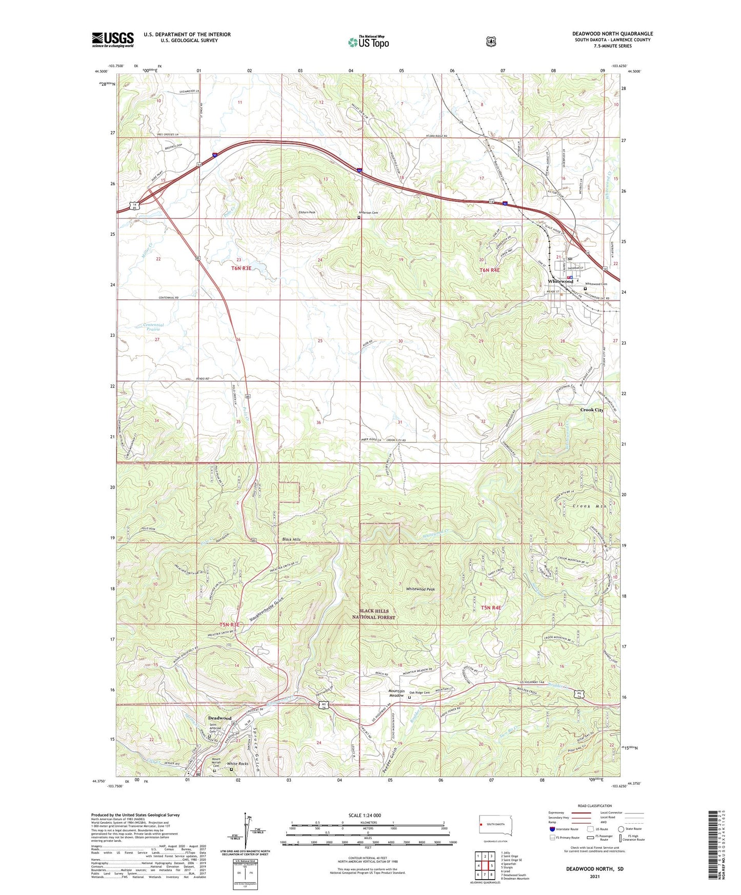
2021 topographic map quadrangle Deadwood North in the state of South Dakota. Scale: 1:24000. Based on the newly updated USGS 7.5' US Topo map series, this map is in the following counties: Lawrence. The map contains contour data, water features, and other items you are used to seeing on USGS maps, but also has updated roads and other features. This is the next generation of topographic maps. Printed on high-quality waterproof paper with UV fade-resistant inks.
Quads adjacent to this one:
West: Spearfish
Northwest: Jolly
North: Saint Onge
Northeast: Saint Onge SE
East: Sturgis
Southeast: Deadman Mountain
South: Deadwood South
Southwest: Lead
This map covers the same area as the classic USGS quad with code o44103d6.
Contains the following named places: Adams Museum, Anderson Cemetery, Black Hills, Centennial City, Centennial Prairie, Chinatown, City Creek, City of Deadwood, City of Whitewood, Crook City, Crook City Census Designated Place, Crook Mountain, Deadwood, Deadwood Post Office, Deadwood Public Library, Elizabethtown, Elkhorn Peak, Glen Baker Irrigation Dam, KDSJ-AM (Deadwood), Lawrence County Courthouse, Lead-Deadwood Elementary School, Miller Creek, Mount Moriah Cemetery, Mountain Meadow, Mountain Meadows I, Nemo District Ranger Station, Oak Flat, Oak Ridge Cemetery, Peedee Gulch, Polo Gulch, Preacher Smith Monument, Saint Ambrose Cemetery, Sandy Creek, Seth Bullock Grave, Slaughterhouse Gulch, Spearfish Emergency Ambulance Service Whitewood, Spring Creek, Spruce Gulch, Tunnel, Two Bit Creek, Valley Ranch, White Rocks, Whitewood, Whitewood Cemetery, Whitewood City Hall, Whitewood Elementary School, Whitewood Peak, Whitewood Police Department, Whitewood Post Office, Whitewood Public Library, Whitewood Volunteer Fire Department