MyTopo
Tabor South Dakota US Topo Map
Couldn't load pickup availability
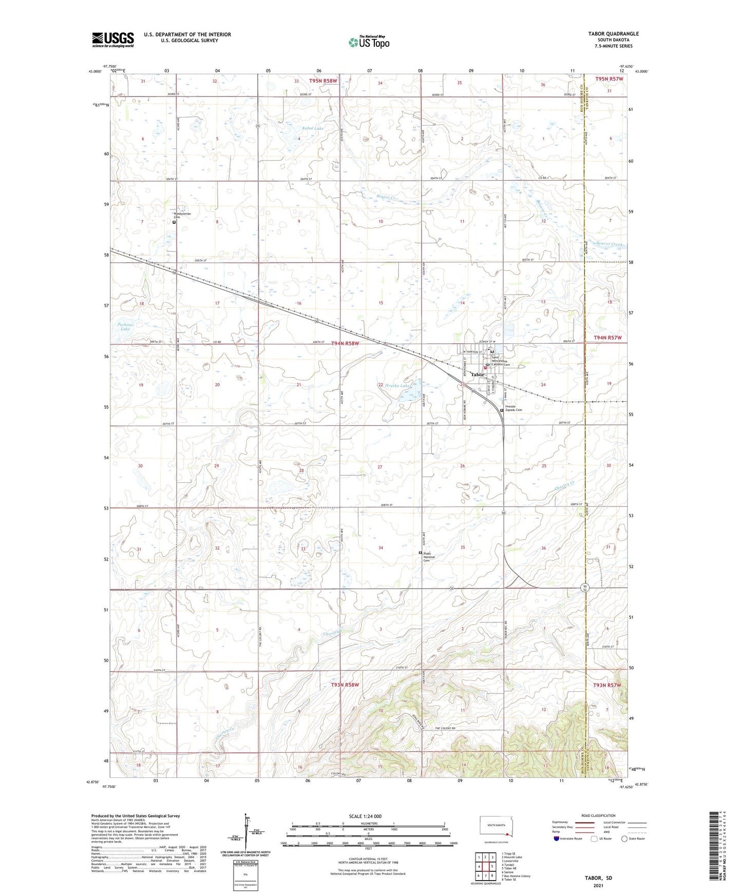
2021 topographic map quadrangle Tabor in the state of South Dakota. Scale: 1:24000. Based on the newly updated USGS 7.5' US Topo map series, this map is in the following counties: Bon Homme, Yankton. The map contains contour data, water features, and other items you are used to seeing on USGS maps, but also has updated roads and other features. This is the next generation of topographic maps. Printed on high-quality waterproof paper with UV fade-resistant inks.
Quads adjacent to this one:
West: Tyndall
Northwest: Tripp SE
North: Kloucek Lake
Northeast: Lesterville
East: Tabor NE
Southeast: Tabor SE
South: Bon Homme Colony
Southwest: Santee
Contains the following named places: Hruska Lake, Hvezda Zapadu Cemetery, Kubal Lake, Pechous Lake, Presbyterian Cemetery, Ptaks National Cemetery, Saint Wenceslaus Catholic Cemetery, Saint Wenceslaus Catholic Church, School Number 24, School Number 25, School Number 26, School Number 27, School Number 59, School Number 62, School Number 63, Tabor, Tabor Community Ambulance Service, Tabor Community Center, Tabor Elementary School, Tabor Fire Department, Tabor Post Office, Tabor Public Library, Town of Tabor, Township of Bon Homme, Township of Tabor, Unorganized Territory of Southeast Bon Homme, ZIP Code: 57063