MyTopo
Grasshopper Creek Tennessee US Topo Map
Couldn't load pickup availability
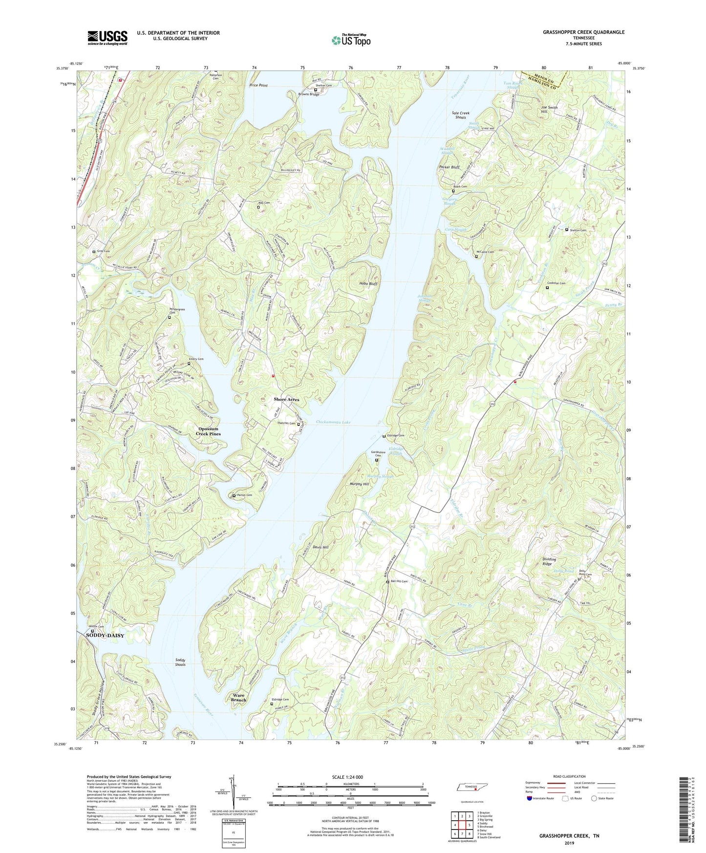
2022 topographic map quadrangle Grasshopper Creek in the state of Tennessee. Scale: 1:24000. Based on the newly updated USGS 7.5' US Topo map series, this map is in the following counties: Hamilton, Meigs. The map contains contour data, water features, and other items you are used to seeing on USGS maps, but also has updated roads and other features. This is the next generation of topographic maps. Printed on high-quality waterproof paper with UV fade-resistant inks.
Quads adjacent to this one:
West: Soddy
Northwest: Brayton
North: Graysville
Northeast: Big Spring
East: Birchwood
Southeast: South Cleveland
South: Snow Hill
Southwest: Daisy
This map covers the same area as the classic USGS quad with code o35085c1.
Contains the following named places: Arcadia Shores, Bakewell School, Ball Hill Cemetery, Bare Branch, Birchwood Church, Bluff View, Browns Bridge, Camp Vesper, Cane Branch, Carp Slough, Chickamauga Fly and Bait Casting Club, Chickamauga Reservoir Airport, Cookston Branch, Cookston Cemetery, Cross Prong, Davis Hill, Dividing Ridge, Dogwood Lodge, Dolly Pond, Dolly Pond Cemetery, Double G Ranch, Eldridge Branch, Eldridge Cemetery, Eldridge Slough, Eldridges Landing, Emery Cemetery, Friendship Church, Friendship School, Gamble Road Church, Gardenhire Cemetery, Grasshopper, Grasshopper Creek, Grasshopper Creek Recreation Area, Gray Cemetery, Gregory Slough, Higgs Ford, Highway 58 Volunteer Fire Department Station 3, Hobo Bluff, Jim Branch, Joe Smith Hill, Johnson Slough, May Branch, May Cemetery, Mayflower Church, McAllys Ferry, McCallie Cemetery, McCormicks Mill, Midway Church, Midway Marina, Mount Annie Church, Mount Tabor Church, Mount Tabor Community Church, Murphy Hill, Murphy Slough, New Liberty Church, Norman Branch, Opossum Creek Pines, Oppossum Creek Ripple, Parker Bluff, Parton Cemetery, Pendergests Mill, Pendergrass Cemetery, Penny Branch, Pennys Ford, Pleasant Grove Church, Possum Creek, Possum Creek Recreation Area, Price Point, Roark Cemetery, Sale Creek, Sale Creek Division, Sale Creek Dock, Sale Creek Recreation Area, Sale Creek Shoals, Sale Creek Volunteer Fire and Rescue Station 1, Sale Creek Volunteer Fire And Rescue Station 3, Salem Church, Salem School, Sauda Islands, Sequoyah Church, Shady Acres, Shady Grove, Shady Grove Boat Harbor, Shady Grove Church, Shady Grove Hollow, Shady Grove Shores, Shelton Cemetery, Shore Acres, Smith Prong, Smith Slough, Soddy Creek, Soddy Shoals, Stephenson Dock, Stulce Prong, Surges Boat Dock, Thatch Branch, Thatcher Cemetery, Thatchers Ford, Tom Roark Slough, Waddell Slough, Ware Branch, Ware Branch Church, Wilcox Cemetery, Zion Church