MyTopo
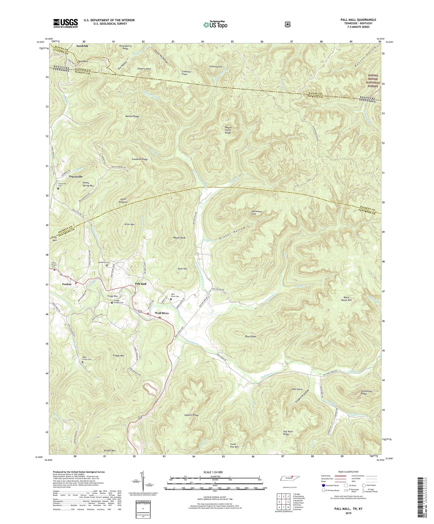
Pall Mall Tennessee US Topo Map
Couldn't load pickup availability
Also explore the Pall Mall Forest Service Topo of this same quad for updated USFS data
2022 topographic map quadrangle Pall Mall in the states of Tennessee, Kentucky. Scale: 1:24000. Based on the newly updated USGS 7.5' US Topo map series, this map is in the following counties: Fentress, Pickett, Wayne, Clinton. The map contains contour data, water features, and other items you are used to seeing on USGS maps, but also has updated roads and other features. This is the next generation of topographic maps. Printed on high-quality waterproof paper with UV fade-resistant inks.
Quads adjacent to this one:
West: Moodyville
Northwest: Savage
North: Powersburg
Northeast: Parmleysville
East: Sharp Place
Southeast: Stockton
South: Jamestown
Southwest: Riverton
This map covers the same area as the classic USGS quad with code o36084e8.
Contains the following named places: Arion Mountain, Bald Rock, Baylor Knob, Big Dry Creek, Black House Mountain, Blue Ridge, Brooks Creek, Brooks Hollow, Brown Chapel, Buckey Lick Creek, Buckeye Lick Creek, Bud Creek, Chestnut Flats, Commissioner District 3, Crabtree Branch, Delk Creek, Dry Hollow Creek, Fallen Water Creek, Fentress County Volunteer Fire Department Station 6 Pall Mall, Fentress County Volunteer Fire Department Station 6 Pall Mall Substation, Fentress Hill, Flat Rock Ridge, Forbus, Forbus School, Frogg Mountain, Frogge Chapel, Frogge Chapel Cemetery, Frogge Mountain, Goodman Ridge, Grapevine Hollow, Greer Chapel, Greer Chapel Cemetery, Honey Spring Mountain, Horseshoe Cliff, Huckleberry Ridge, Jane Point, Jesse Creek, Jim Creek, Leffew Mine, Little Dry Creek, Little Jack Creek, Lynch Pinnacle, Pall Mall, Pall Mall Post Office, Pogue Creek, Reed Creek, Reed Creek Cemetery, Riley Mountain, Rocky Creek, Rotten Fork School, Rotten Fork Wolf River, Sandclift, Sandclift Post Office, Sawmill Ridge, Sergeant Alvin York Mill State Historic Area, Shellotte Branch, Short Horn Creek, Slippery Rock, Spruce Pin Hollow, Statehouse Ridge, Steve Pile Mountain, Stewart Creek, Stokes Creek, Tater Hill, Travisville, Travisville Cemetery, Travisville Church, Travisville School, Upchurch Cemetery, Upchurch Church, Watson Ridge, Wayne Trace Ridge, Williams Creek, Wolf River, Wolf River Cemetery, Wolf River Church, York Bible School, York Chapel, ZIP Code: 38577