MyTopo
Savage Kentucky US Topo Map
Couldn't load pickup availability
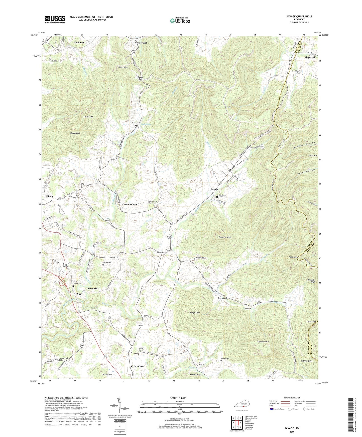
2022 topographic map quadrangle Savage in the state of Kentucky. Scale: 1:24000. Based on the newly updated USGS 7.5' US Topo map series, this map is in the following counties: Clinton, Wayne. The map contains contour data, water features, and other items you are used to seeing on USGS maps, but also has updated roads and other features. This is the next generation of topographic maps. Printed on high-quality waterproof paper with UV fade-resistant inks.
Quads adjacent to this one:
West: Albany
Northwest: Wolf Creek Dam
North: Cumberland City
Northeast: Parnell
East: Powersburg
Southeast: Pall Mall
South: Moodyville
Southwest: Byrdstown
This map covers the same area as the classic USGS quad with code o36085f1.
Contains the following named places: Albany Rock, Beach Bottom Church, Beatty School, Beaty Cemetery, Beech Bottom, Beech Bottom School, Braswell, Braswell School, Buffalo Ridge, Bug, Bug Post Office, Caney Gap Post Office, Caney Gap School, Cannons Mill, Cannons Mill Post Office, Cedar Knob, Cedar Knob Post Office, Cedar Point Post Office, Central Grove Church, Central Grove Church Cemetery, Clearfork School, Clinton Chapel Cemetery, Concord, Concord Church, Concord School, Cooks Spring, Cooley Mill, Copperas Knob, Cowan School, Duvall Creek, Duvall Valley, Duvall Valley Church, Gwinn Cemetery, Hays Creek, Huff Branch, Huffs Coal Bank, Irvin Cemetery, Irvin School, Irvins Elementary School, Jacks Knob, Jennys Knob, Jones Mill, Kennedy Mountain, Koger Creek, Koger Mountain, Little Cliff, Looper Cemetery, Lower Oak Grove School, Maupin, Maupin Church, Maupin Church Cemetery, Maupin Post Office, Maupin School, McIver Creek, Neals Store, Oak Grove Church, Oak Grove Church Cemetery, Pikeview, Pikeview School, Pikeville Church, Pinnacle Cliff, Possum Kingdom, Rolan, Rolan Post Office, Russells Mill, Savage, Savage Cemetery, Savage Lookout Tower, Savage Post Office, Sewell Mountain, Smith Chapel, Smith Creek, The Blue Mud, The Wolf Den, Upchurch, Upchurch Post Office, Upper Oak Grove School, Wades Gap, ZIP Code: 42602