MyTopo
Blucher Mountain Texas US Topo Map
Couldn't load pickup availability
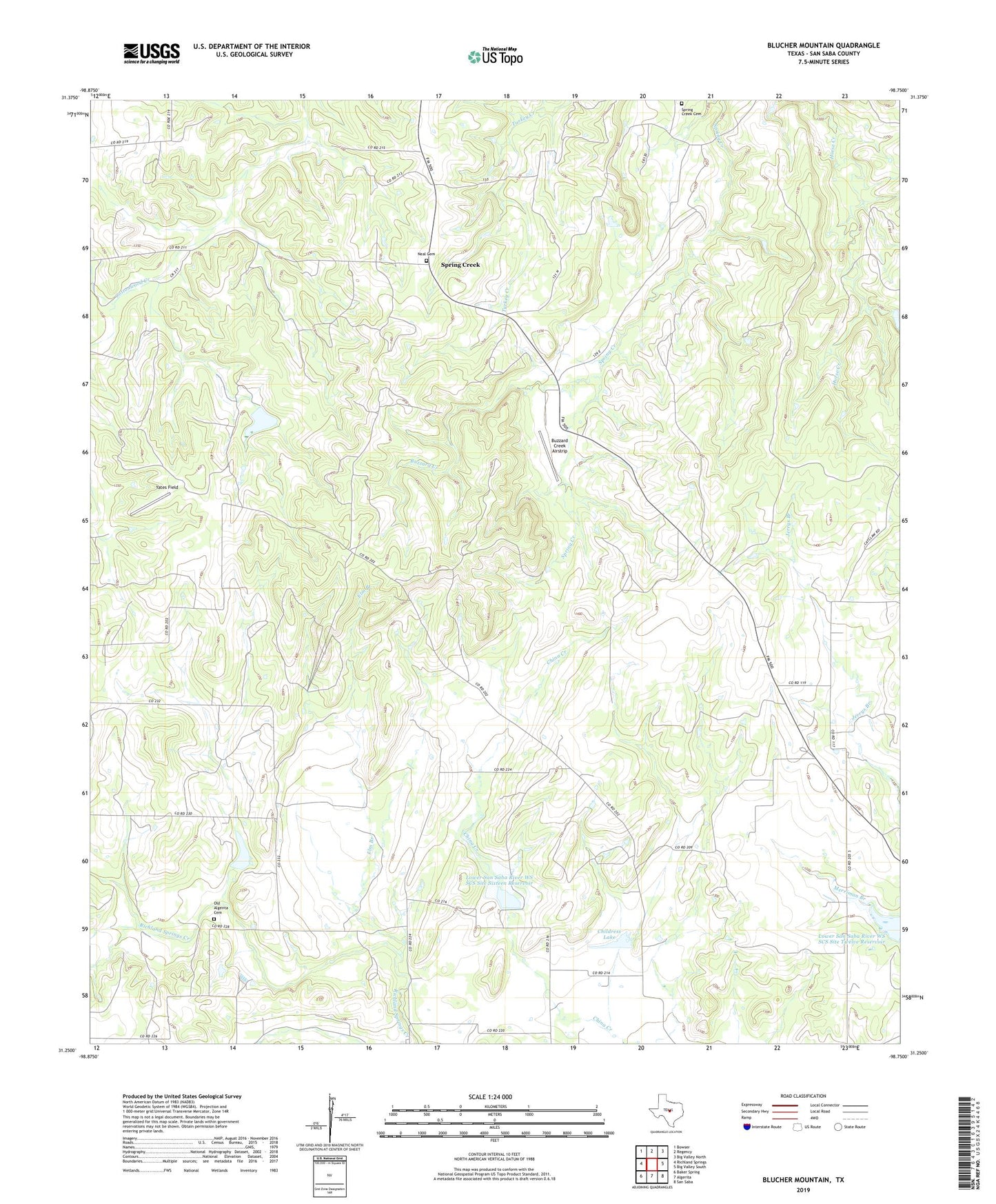
2022 topographic map quadrangle Blucher Mountain in the state of Texas. Scale: 1:24000. Based on the newly updated USGS 7.5' US Topo map series, this map is in the following counties: San Saba. The map contains contour data, water features, and other items you are used to seeing on USGS maps, but also has updated roads and other features. This is the next generation of topographic maps. Printed on high-quality waterproof paper with UV fade-resistant inks.
Quads adjacent to this one:
West: Richland Springs
Northwest: Bowser
North: Regency
Northeast: Big Valley North
East: Big Valley South
Southeast: San Saba
South: Algerita
Southwest: Baker Spring
This map covers the same area as the classic USGS quad with code o31098c7.
Contains the following named places: Buzzard Creek, Buzzard Creek Airstrip, Childress Lake, Childress Lake Dam, China Creek, Elm Branch, Fairview, Horse Creek, Lower San Saba River WS SCS Site Sixteen Reservoir, Lower San Saba River WS SCS Site Twelve Reservoir, Neal Cemetery, Old Algerita Cemetery, Richland Springs Division, Soil Conservation Service Site 12 Dam, Soil Conservation Service Site 16 Dam, Spring Creek, Spring Creek Cemetery, Yates Field