MyTopo
Fall Creek Texas US Topo Map
Couldn't load pickup availability
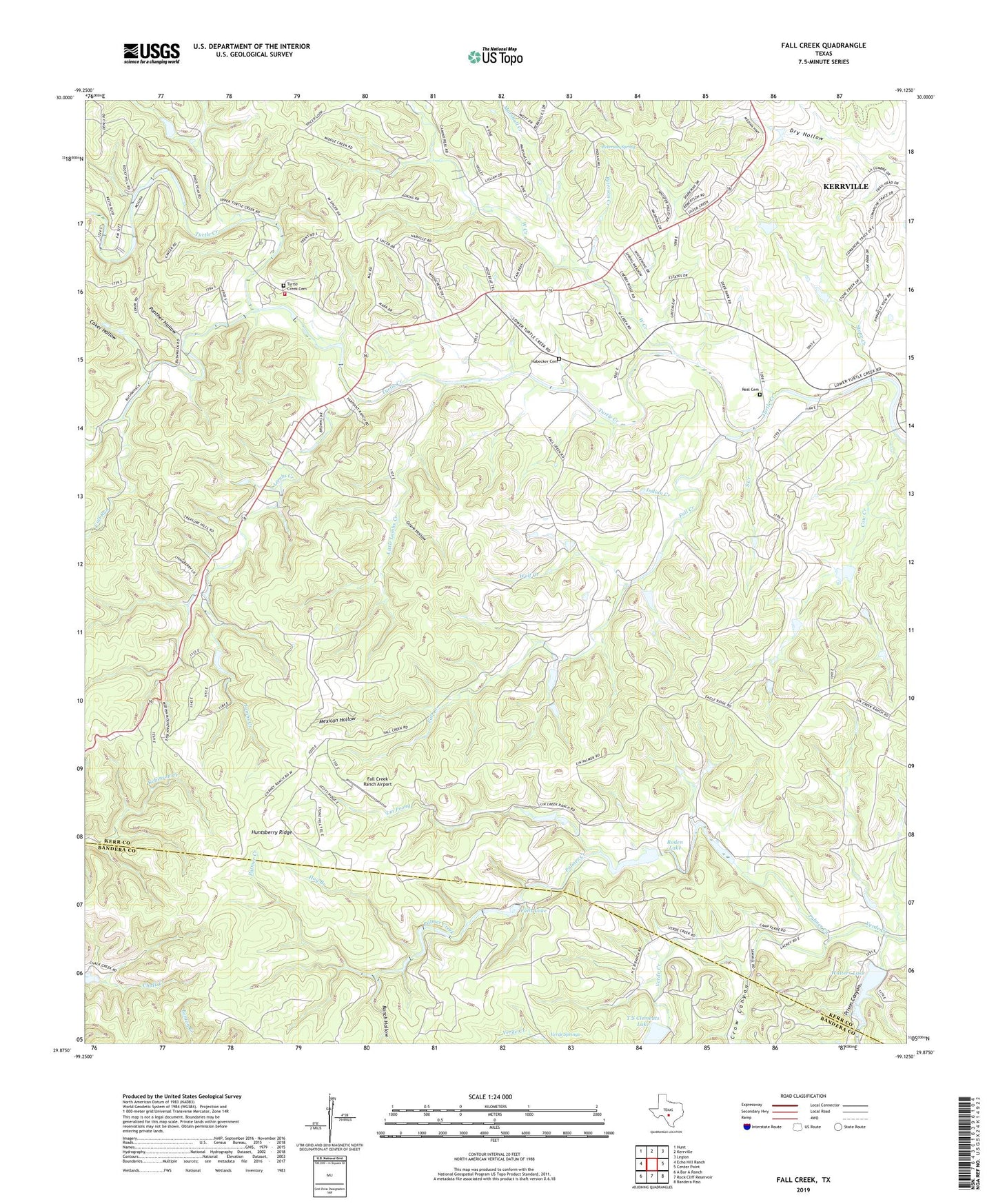
2022 topographic map quadrangle Fall Creek in the state of Texas. Scale: 1:24000. Based on the newly updated USGS 7.5' US Topo map series, this map is in the following counties: Kerr, Bandera. The map contains contour data, water features, and other items you are used to seeing on USGS maps, but also has updated roads and other features. This is the next generation of topographic maps. Printed on high-quality waterproof paper with UV fade-resistant inks.
Quads adjacent to this one:
West: Echo Hill Ranch
Northwest: Hunt
North: Kerrville
Northeast: Legion
East: Center Point
Southeast: Bandera Pass
South: Rock Cliff Reservoir
Southwest: A Bar A Ranch
This map covers the same area as the classic USGS quad with code o29099h2.
Contains the following named places: Barclays Roost Airport, Bushwhack Creek, Calf Run, Camp Chrysalis, Camp Maddox, Coker Hollow, Cow Creek, Crow Canyon, Fall Creek, Fall Creek Ranch Airport, Falls Lake, Falls Lake Dam, Grave Hollow, Habecker Cemetery, Hog Branch, Huntsberry Ridge, Indian Creek, Kickapoo Camp, Lambs Creek, Lin Prong, Little Lambs Creek, Marshall Creek, Mexican Hollow, Palmer Creek, Panther Hollow, Peterson Creek, Peterson Spring, Prison Canyon, Ranch Hollow, Real Cemetery, Roden Lake, Roden Lake Dam, South Creek, Stone Creek, T S Clements Dam, T S Clements Lake, Turtle Creek Cemetery, Turtle Creek Volunteer Fire Department, Verde Springs, Walters Dam, Walters Lake, West Creek, Wolf Creek