MyTopo
Trickham Texas US Topo Map
Couldn't load pickup availability
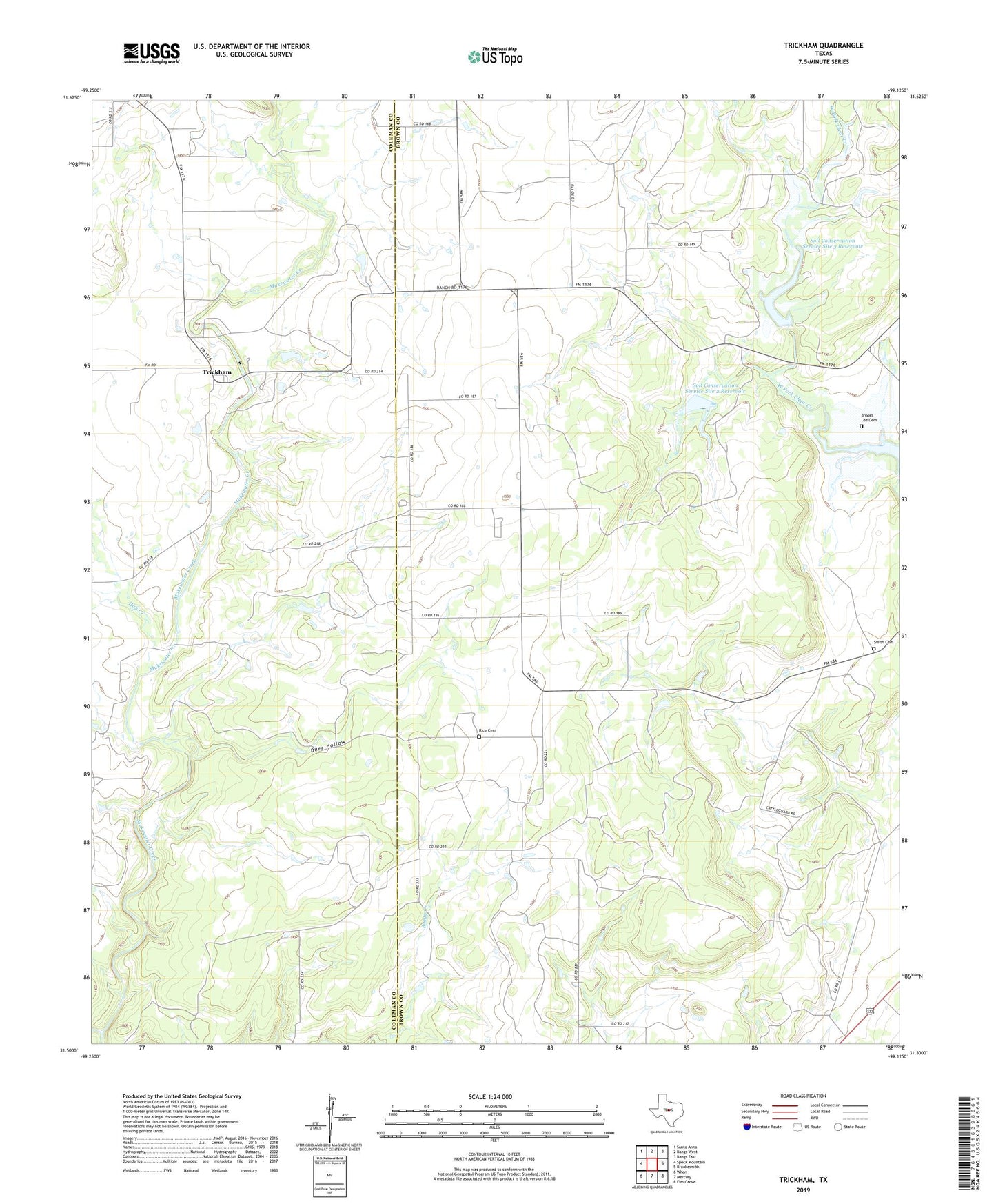
2022 topographic map quadrangle Trickham in the state of Texas. Scale: 1:24000. Based on the newly updated USGS 7.5' US Topo map series, this map is in the following counties: Brown, Coleman. The map contains contour data, water features, and other items you are used to seeing on USGS maps, but also has updated roads and other features. This is the next generation of topographic maps. Printed on high-quality waterproof paper with UV fade-resistant inks.
Quads adjacent to this one:
West: Speck Mountain
Northwest: Santa Anna
North: Bangs West
Northeast: Bangs East
East: Brookesmith
Southeast: Elm Grove
South: Mercury
Southwest: Whon
This map covers the same area as the classic USGS quad with code o31099e2.
Contains the following named places: Brooks Lee Cemetery, Carr - Smith Cemetery, Deer Hollow, Hay Creek, Mount View Church, Mukewater Creek, Rice Cemetery, Soil Conservation Service Site 1 Dam, Soil Conservation Service Site 1 Reservoir, Soil Conservation Service Site 2 Dam, Soil Conservation Service Site 2 Reservoir, Soil Conservation Service Site 3 Dam, Soil Conservation Service Site 3 Reservoir, Trickham, ZIP Code: 76827