MyTopo
Brookesmith Texas US Topo Map
Couldn't load pickup availability
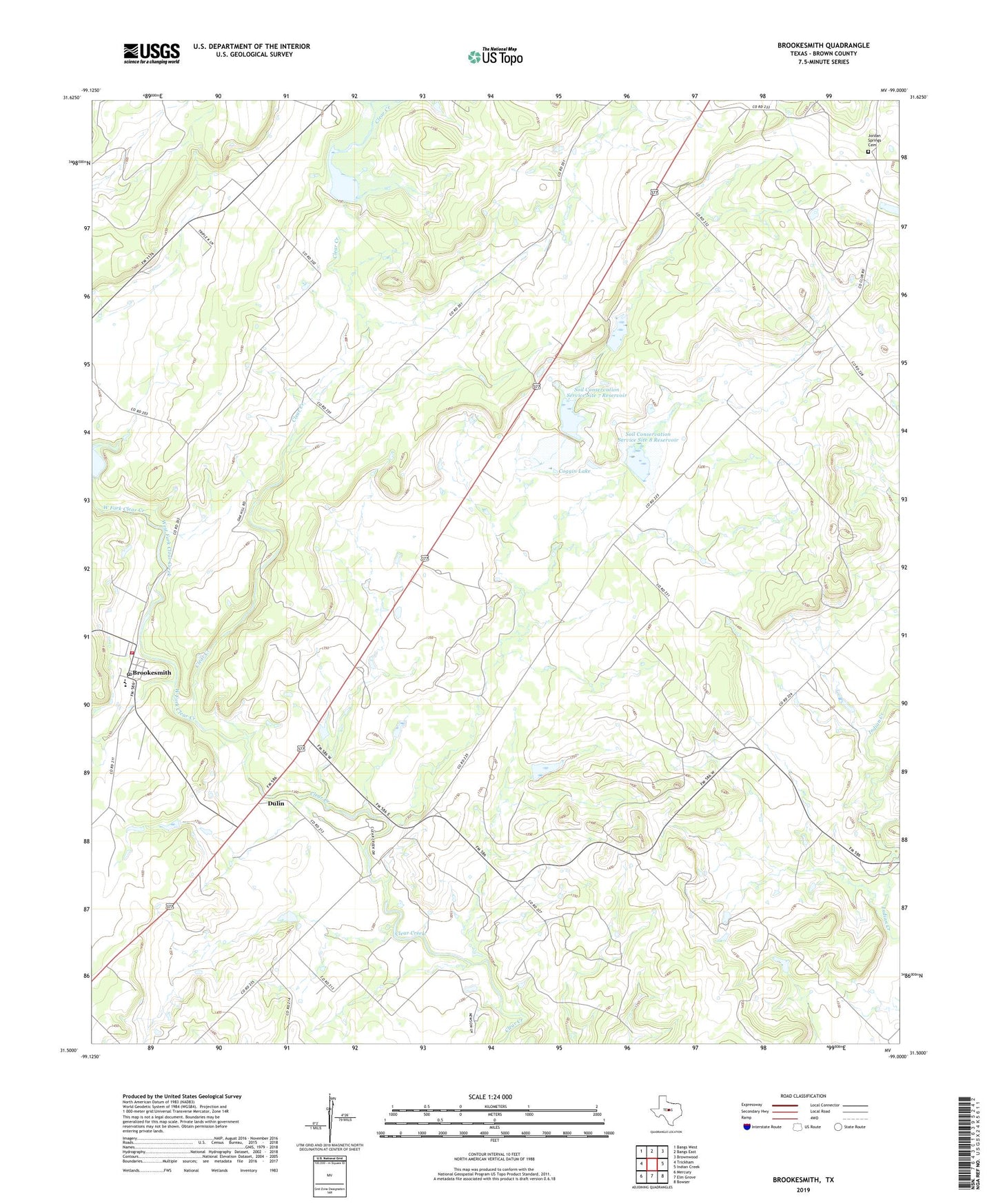
2022 topographic map quadrangle Brookesmith in the state of Texas. Scale: 1:24000. Based on the newly updated USGS 7.5' US Topo map series, this map is in the following counties: Brown. The map contains contour data, water features, and other items you are used to seeing on USGS maps, but also has updated roads and other features. This is the next generation of topographic maps. Printed on high-quality waterproof paper with UV fade-resistant inks.
Quads adjacent to this one:
West: Trickham
Northwest: Bangs West
North: Bangs East
Northeast: Brownwood
East: Indian Creek
Southeast: Bowser
South: Elm Grove
Southwest: Mercury
This map covers the same area as the classic USGS quad with code o31099e1.
Contains the following named places: Brookesmith, Brookesmith Post Office, Brookesmith Volunteer Fire Department, Brownwood Division, Coggin Lake, Coggin Lake Dam, Dulin, Heald-Kennedy Dam, Heald-Kennedy Lake, Jordan Springs Cemetery, Pearsall Public Library, Soil Conservation Service Site 6 Dam, Soil Conservation Service Site 6 Reservoir, Soil Conservation Service Site 7 Dam, Soil Conservation Service Site 7 Reservoir, Soil Conservation Service Site 8 Dam, Soil Conservation Service Site 8 Reservoir, West Fork Clear Creek