MyTopo
Bleakwood Texas US Topo Map
Couldn't load pickup availability
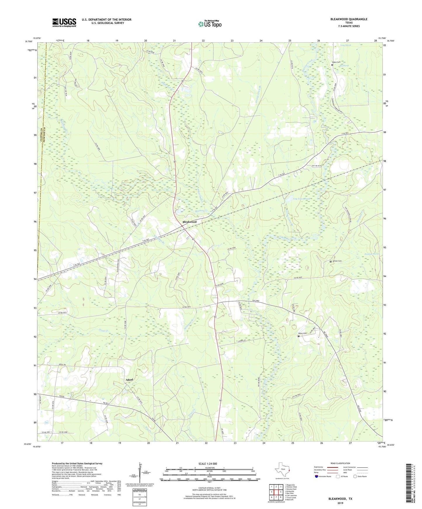
2019 topographic map quadrangle Bleakwood in the state of Texas. Scale: 1:24000. Based on the newly updated USGS 7.5' US Topo map series, this map is in the following counties: Newton, Jasper. The map contains contour data, water features, and other items you are used to seeing on USGS maps, but also has updated roads and other features. This is the next generation of topographic maps. Printed on high-quality waterproof paper with UV fade-resistant inks.
Quads adjacent to this one:
West: Kirbyville
Northwest: Roganville
North: Newton West
Northeast: Newton East
East: Bon Wier
Southeast: Bancroft
South: Trout Creek
Southwest: Call Junction
Contains the following named places: Adsul, Big Marsh, Biloxi Cemetery, Biloxi Church, Bleakwood, Donahoe Marsh, Dry Creek, E O Siecke State Forest, Everett Creek, George Lewis Branch, Harrells, Howards, Lewis Chapel, Log Town Pond, Long Marsh, McFarland - Wilson Cemetery, Odom Cemetery, Pilgrim Church, Thickety Creek, Trout Creek Nature Trail, Watson Chapel, White Oak Creek, Whitman Branch