MyTopo
Cherokee Texas US Topo Map
Couldn't load pickup availability
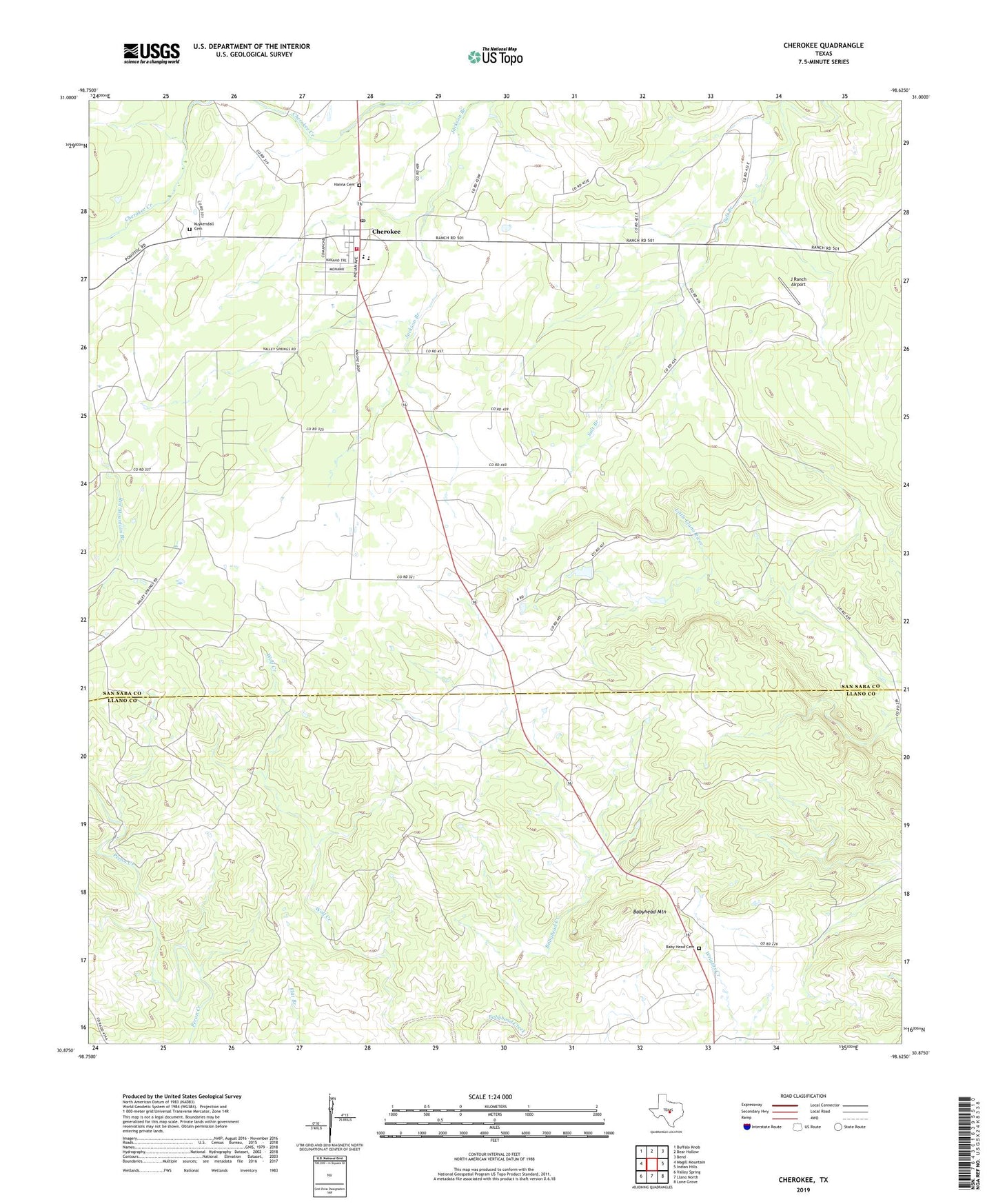
2022 topographic map quadrangle Cherokee in the state of Texas. Scale: 1:24000. Based on the newly updated USGS 7.5' US Topo map series, this map is in the following counties: San Saba, Llano. The map contains contour data, water features, and other items you are used to seeing on USGS maps, but also has updated roads and other features. This is the next generation of topographic maps. Printed on high-quality waterproof paper with UV fade-resistant inks.
Quads adjacent to this one:
West: Magill Mountain
Northwest: Buffalo Knob
North: Bear Hollow
Northeast: Bend
East: Indian Hills
Southeast: Lone Grove
South: Llano North
Southwest: Valley Spring
This map covers the same area as the classic USGS quad with code o30098h6.
Contains the following named places: Baby Head, Baby Head Cemetery, Babyhead Mountain, Babyhead School, Cherokee, Cherokee Post Office, Cherokee Volunteer Fire Department, Hanna Cemetery, Indian Stadium, J Ranch Airport, Kemp Creek, Kuykendall Cemetery, Wolf Creek, Woodward Branch, ZIP Code: 76832