MyTopo
Speck Mountain Texas US Topo Map
Couldn't load pickup availability
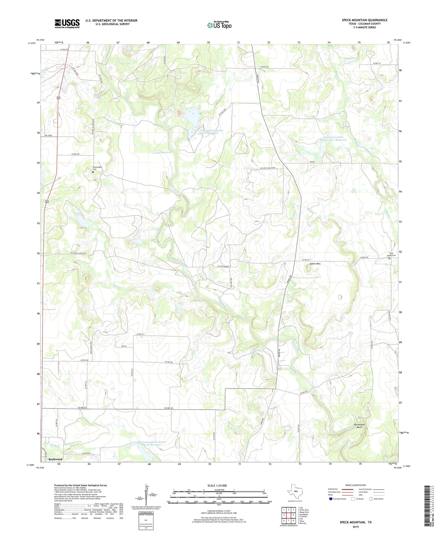
2022 topographic map quadrangle Speck Mountain in the state of Texas. Scale: 1:24000. Based on the newly updated USGS 7.5' US Topo map series, this map is in the following counties: Coleman. The map contains contour data, water features, and other items you are used to seeing on USGS maps, but also has updated roads and other features. This is the next generation of topographic maps. Printed on high-quality waterproof paper with UV fade-resistant inks.
Quads adjacent to this one:
West: Gouldbusk
Northwest: Fisk
North: Santa Anna
Northeast: Bangs West
East: Trickham
Southeast: Mercury
South: Whon
Southwest: Fife
This map covers the same area as the classic USGS quad with code o31099e3.
Contains the following named places: Dry Creek, Five Ashes Cemetery, Horseshoe Bend, La Vista Ranch, Rockwood, Santa Anna Division, Soil Conservation Service Site 1 Dam, Soil Conservation Service Site 1 Reservoir, Soil Conservation Service Site 18 Dam, Soil Conservation Service Site 18 Reservoir, Soil Conservation Service Site 19 Dam, Soil Conservation Service Site 19 Reservoir, Soil Conservation Service Site 2 Dam, Soil Conservation Service Site 2 Reservoir, Soil Conservation Service Site 21 Dam, Soil Conservation Service Site 21 Reservoir, Speck Mountain, Stewardson Cemetery