MyTopo
Freemound Texas US Topo Map
Couldn't load pickup availability
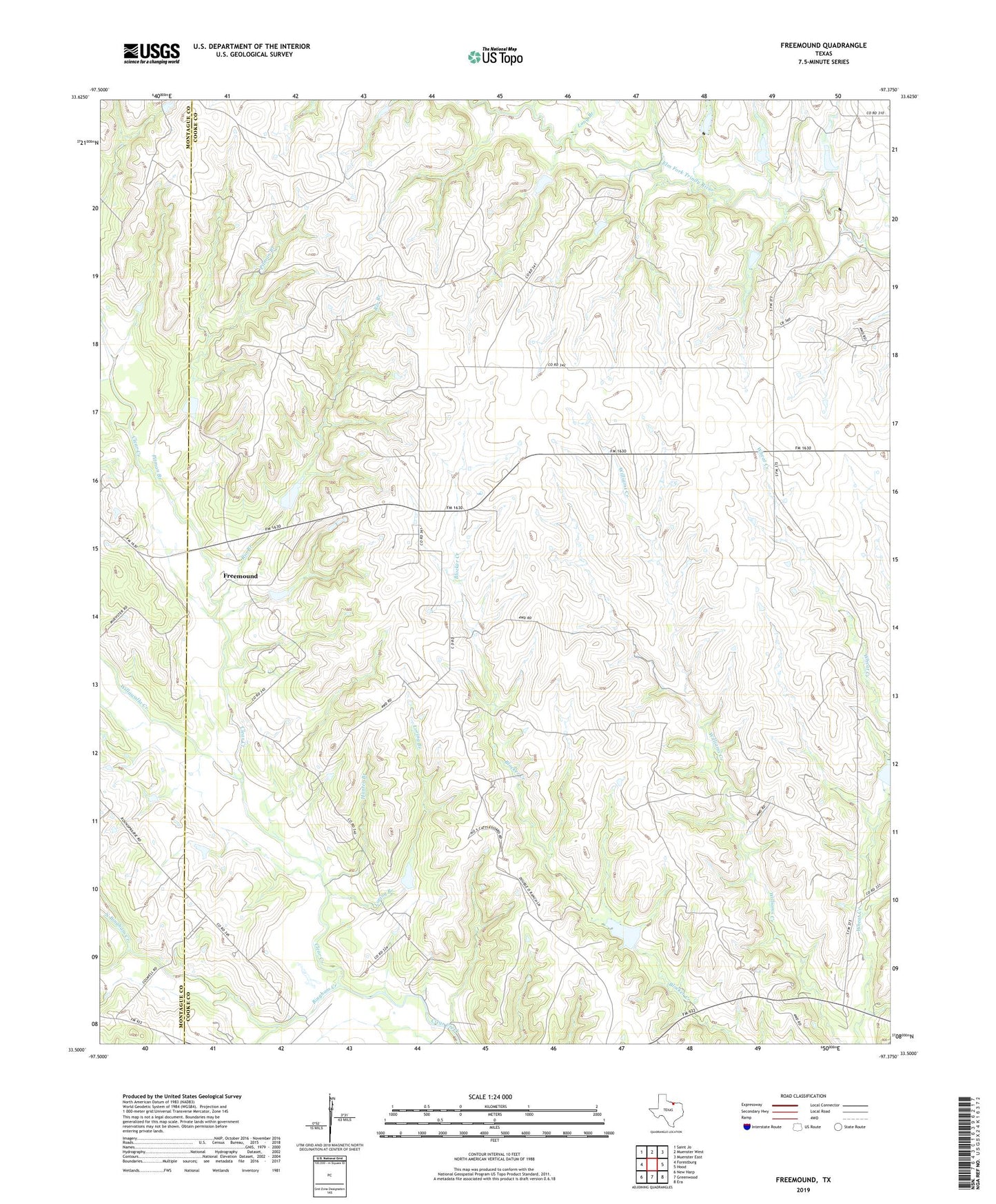
2022 topographic map quadrangle Freemound in the state of Texas. Scale: 1:24000. Based on the newly updated USGS 7.5' US Topo map series, this map is in the following counties: Cooke, Montague. The map contains contour data, water features, and other items you are used to seeing on USGS maps, but also has updated roads and other features. This is the next generation of topographic maps. Printed on high-quality waterproof paper with UV fade-resistant inks.
Quads adjacent to this one:
West: Forestburg
Northwest: Saint Jo
North: Muenster West
Northeast: Muenster East
East: Hood
Southeast: Era
South: Greenwood
Southwest: New Harp
This map covers the same area as the classic USGS quad with code o33097e4.
Contains the following named places: Bingham Creek, Cleburne Municipal Library, Dangel Oil Field, Freemound, Gatewood Oil Field, Hunter Branch, Joshua Public Library, Long Branch, Loring Branch, North Bingham Creek, Pitman Branch, Rio Branch, Soil Conservation Service Site 15 Dam, Soil Conservation Service Site 15 Reservoir, Soil Conservation Service Site 16 Dam, Soil Conservation Service Site 16 Reservoir, Soil Conservation Service Site 17 Dam, Soil Conservation Service Site 17 Reservoir, Soil Conservation Service Site 19 Dam, Soil Conservation Service Site 19 Reservoir, Soil Conservation Service Site 43a Dam, Soil Conservation Service Site 43a Reservoir, Soil Conservation Service Site 45 Dam, Soil Conservation Service Site 45 Reservoir, Soil Conservation Service Site 60 Dam, Soil Conservation Service Site 60 Reservoir, Soil Conservation Service Site 61d Dam, Soil Conservation Service Site 61d Reservoir, Soil Conservation Service Site 61f Dam, Soil Conservation Service Site 61f Reservoir, Soil Conservation Service Site 61g Dam, Soil Conservation Service Site 61g Reservoir, Soil Conservation Service Site 6h Dam, Soil Conservation Service Site 6h Reservoir, Soil Conservation Service Site 6m Dam, Soil Conservation Service Site 6m Reservoir, Soil Conservation Service Site 6n Dam, Soil Conservation Service Site 6n Reservoir, South Bingham Creek, Voth Oil Field, Willawalla Creek