MyTopo
Hammetts Crossing Texas US Topo Map
Couldn't load pickup availability
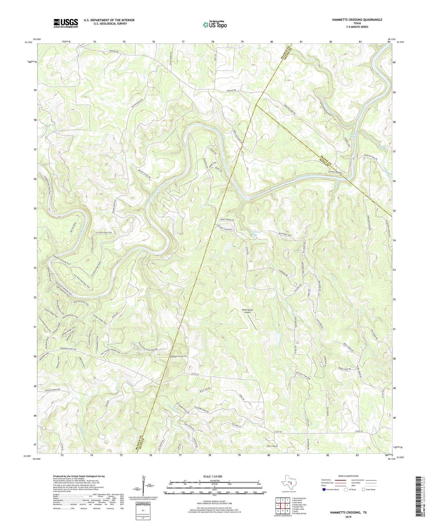
2019 topographic map quadrangle Hammetts Crossing in the state of Texas. Scale: 1:24000. Based on the newly updated USGS 7.5' US Topo map series, this map is in the following counties: Blanco, Hays, Travis. The map contains contour data, water features, and other items you are used to seeing on USGS maps, but also has updated roads and other features. This is the next generation of topographic maps. Printed on high-quality waterproof paper with UV fade-resistant inks.
Quads adjacent to this one:
West: Pedernales Falls
Northwest: Round Mountain
North: Spicewood
Northeast: Pace Bend
East: Shingle Hills
Southeast: Dripping Springs
South: Henly
Southwest: Yeager Creek
Contains the following named places: Calohan Creek, Cypress Creek, Dead Mans Ford, Dead Mans Hole, Duval County Library, Flat Creek, Fou Mile Loop, Hamilton Creek, Hamilton Pool, Hamilton Pool Park, Hamilton Pool Park Trail, Hammetts Crossing, Keyes Ranch Airport, Pedernales Falls State Park, Purola Lake, Purola Lake Dam, Roy Creek, Sycamore Creek, West Cave Spring