MyTopo
Spicewood Texas US Topo Map
Couldn't load pickup availability
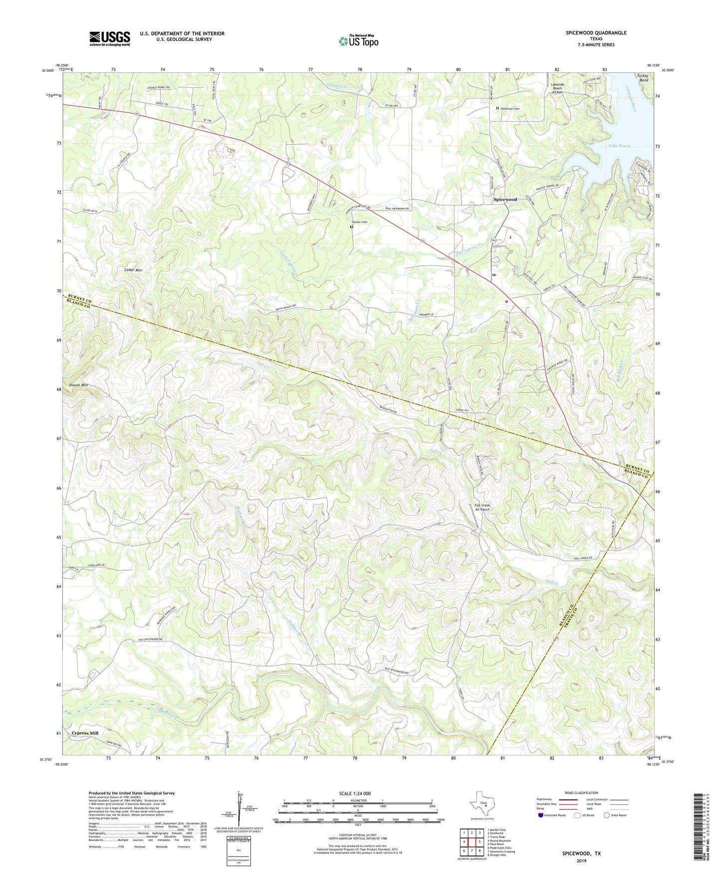
2022 topographic map quadrangle Spicewood in the state of Texas. Scale: 1:24000. Based on the newly updated USGS 7.5' US Topo map series, this map is in the following counties: Blanco, Burnet, Travis. The map contains contour data, water features, and other items you are used to seeing on USGS maps, but also has updated roads and other features. This is the next generation of topographic maps. Printed on high-quality waterproof paper with UV fade-resistant inks.
Quads adjacent to this one:
West: Round Mountain
Northwest: Marble Falls
North: Smithwick
Northeast: Travis Peak
East: Pace Bend
Southeast: Shingle Hills
South: Hammetts Crossing
Southwest: Pedernales Falls
This map covers the same area as the classic USGS quad with code o30098d2.
Contains the following named places: Cedar Mountain, Fall Creek Air Ranch, Fowler Cemetery, Grelle Recreation Area Trail, Highway Seventyone Church, Holloway Cemetery, Little Cypress Creek, Love Creek, Shovel Mountain, Spicewood, Spicewood Post Office, Spicewood Quarry, Spicewood Volunteer Fire Department and Emergency Medical Services, Sycamore Creek, Wallace Branch