MyTopo
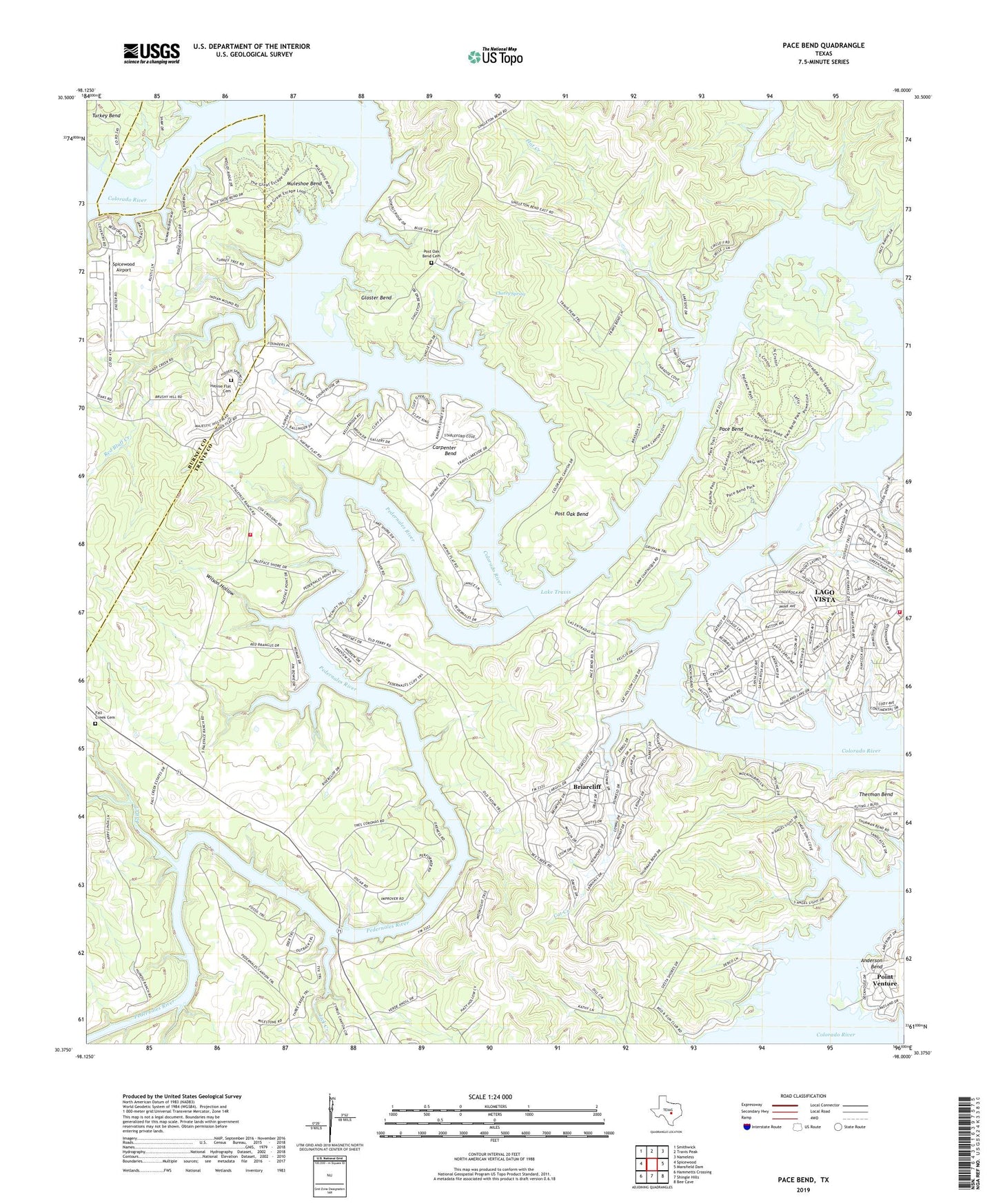
Pace Bend Texas US Topo Map
Couldn't load pickup availability
2022 topographic map quadrangle Pace Bend in the state of Texas. Scale: 1:24000. Based on the newly updated USGS 7.5' US Topo map series, this map is in the following counties: Travis, Burnet. The map contains contour data, water features, and other items you are used to seeing on USGS maps, but also has updated roads and other features. This is the next generation of topographic maps. Printed on high-quality waterproof paper with UV fade-resistant inks.
Quads adjacent to this one:
West: Spicewood
Northwest: Smithwick
North: Travis Peak
Northeast: Nameless
East: Mansfield Dam
Southeast: Bee Cave
South: Shingle Hills
Southwest: Hammetts Crossing
This map covers the same area as the classic USGS quad with code o30098d1.
Contains the following named places: Austin / Travis County Emergency Medical Service - Rescue 22, Briarcliff, Briarcliff City Hall, Camp Texlake, Carpenter Bend, Cat Creek, Cherry Spring, Cow Creek, Fall Creek, Fall Creek Cemetery, Flat Creek, Gloster Bend, Haynie Flat Cemetery, Highland Lake, Lake Travis, Lick Creek, Muleshoe Bend, Muleshoe Bend Trail, Pace Bend, Pace Bend Park, Pace Bend Park Trail, Pedernales Emergency Services, Pedernales River, Post Oak Bend, Post Oak Bend Cemetery, Red Bluff Creek, Saint Peters Episcopal Church, Spicewood Airport, Therman Bend, Travis County Emergency Service District Number 1 Station 103, Travis County Emergency Service District Number 1 Station 105, Travis County Emergency Services District 8 Station 3 Pedernales, Turkey Bend, Village of Briarcliff, Village of Point Venture, Wilson Hollow, ZIP Code: 78669