MyTopo
Round Mountain Texas US Topo Map
Couldn't load pickup availability
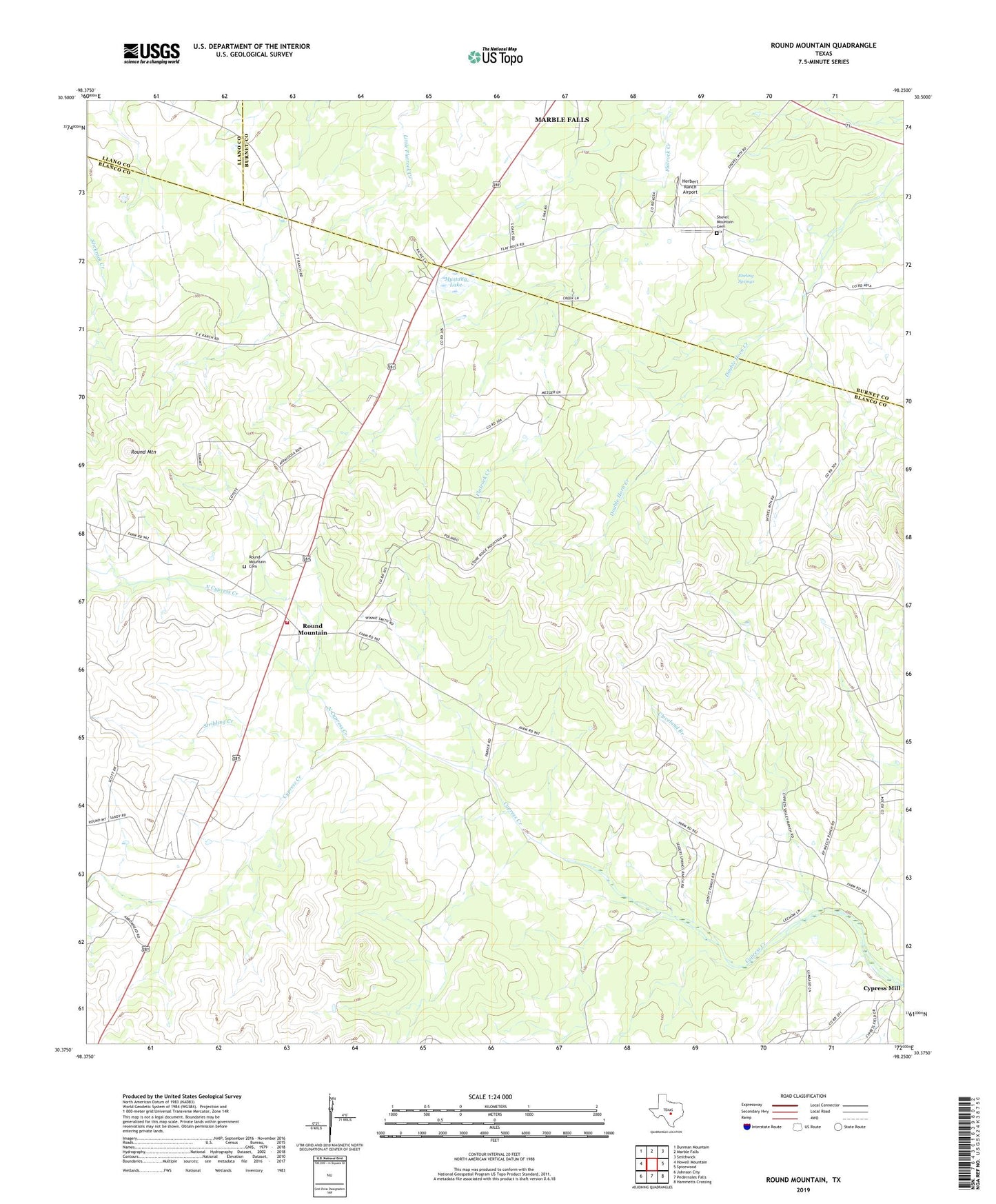
2022 topographic map quadrangle Round Mountain in the state of Texas. Scale: 1:24000. Based on the newly updated USGS 7.5' US Topo map series, this map is in the following counties: Blanco, Burnet, Llano. The map contains contour data, water features, and other items you are used to seeing on USGS maps, but also has updated roads and other features. This is the next generation of topographic maps. Printed on high-quality waterproof paper with UV fade-resistant inks.
Quads adjacent to this one:
West: Howell Mountain
Northwest: Dunman Mountain
North: Marble Falls
Northeast: Smithwick
East: Spicewood
Southeast: Hammetts Crossing
South: Pedernales Falls
Southwest: Johnson City
This map covers the same area as the classic USGS quad with code o30098d3.
Contains the following named places: Cleveland Branch, Cypress Mill, Ebeling Springs, Herbert Ranch Airport, Mustang Lake, North Cypress Creek, Round Mountain, Round Mountain Cemetery, Round Mountain Post Office, Round Mountain Stage-Coach Inn and Stable, Round Mountain Volunteer Fire Department, Shovel Mountain, Shovel Mountain Cemetery, Stribling Creek, Town of Round Mountain, ZIP Code: 78663