MyTopo
La Sal Vieja Texas US Topo Map
Couldn't load pickup availability
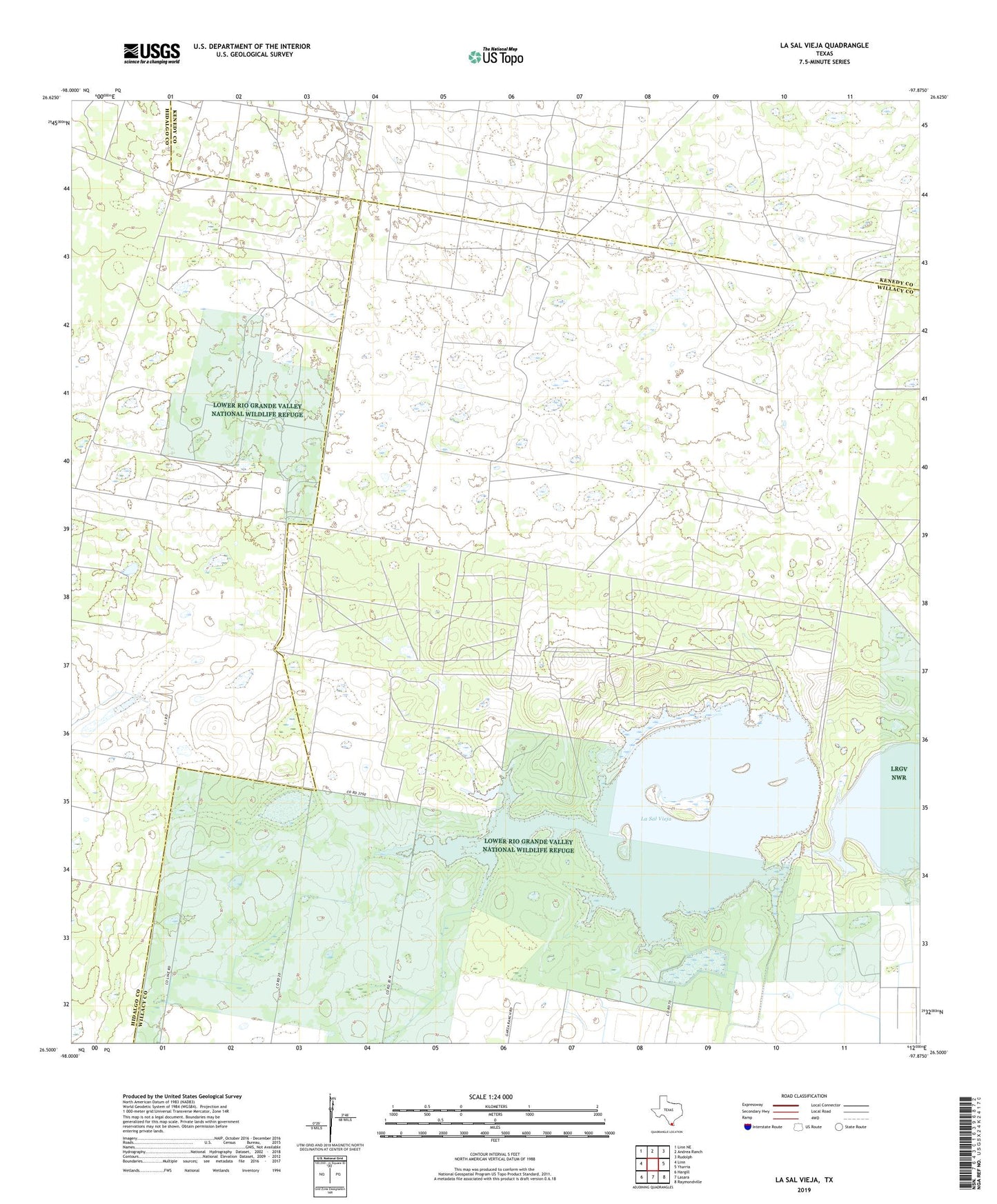
2022 topographic map quadrangle La Sal Vieja in the state of Texas. Scale: 1:24000. Based on the newly updated USGS 7.5' US Topo map series, this map is in the following counties: Willacy, Hidalgo, Kenedy. The map contains contour data, water features, and other items you are used to seeing on USGS maps, but also has updated roads and other features. This is the next generation of topographic maps. Printed on high-quality waterproof paper with UV fade-resistant inks.
Quads adjacent to this one:
West: Linn
Northwest: Linn NE
North: Andrea Ranch
Northeast: Rudolph
East: Yturria
Southeast: Raymondville
South: Lasara
Southwest: Hargill
This map covers the same area as the classic USGS quad with code o26097e8.
Contains the following named places: Jesus Maria Windmill, Juan Barrientos Windmill, La Sal Vieja, La Sal Vieja Ranch, La Tordilla Windmill, Lasara Division, Salvado Windmill, San Jose de los Llantos Windmill, San Leonardo Windmill, San Pedro Well, San Pedro Windmill