
MyTopo
Hockley Mound Texas US Topo Map
Couldn't load pickup availability
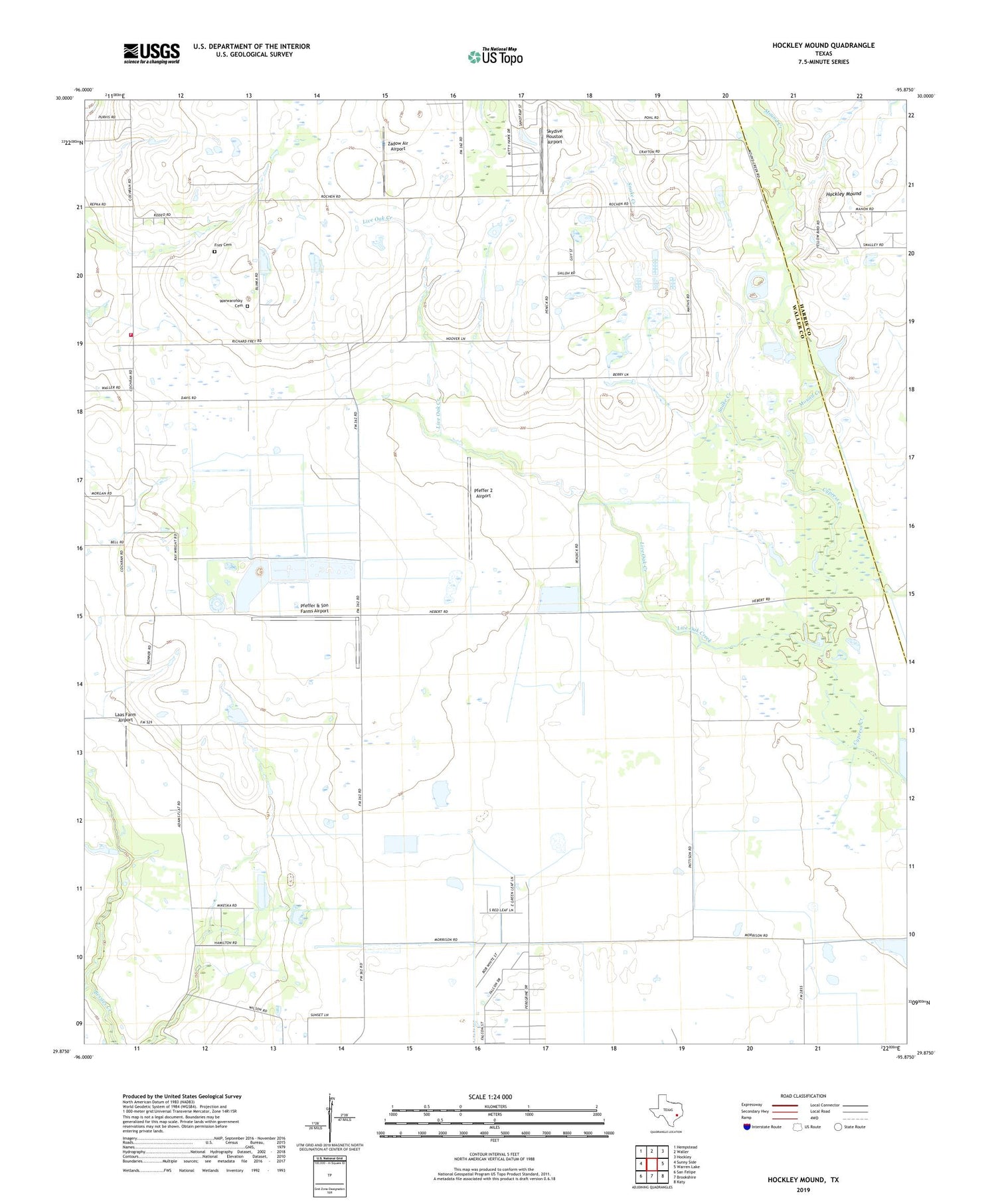
2019 topographic map quadrangle Hockley Mound in the state of Texas. Scale: 1:24000. Based on the newly updated USGS 7.5' US Topo map series, this map is in the following counties: Waller, Harris. The map contains contour data, water features, and other items you are used to seeing on USGS maps, but also has updated roads and other features. This is the next generation of topographic maps. Printed on high-quality waterproof paper with UV fade-resistant inks.
Quads adjacent to this one:
West: Sunny Side
Northwest: Hempstead
North: Waller
Northeast: Hockley
East: Warren Lake
Southeast: Katy
South: Brookshire
Southwest: San Felipe
Contains the following named places: Frey Cemetery, Hockley Mound, Laas Farm Airport, Live Oak Creek, Monaville Volunteer Fire Department, Mound Creek, Pfeffer & Son Farms Airport, Pfeffer 2 Airport, Skydive Houston Airport, Snake Creek, Warwarofsky Cemetery, Zadow Air Airport


