MyTopo
Hempstead Texas US Topo Map
Couldn't load pickup availability
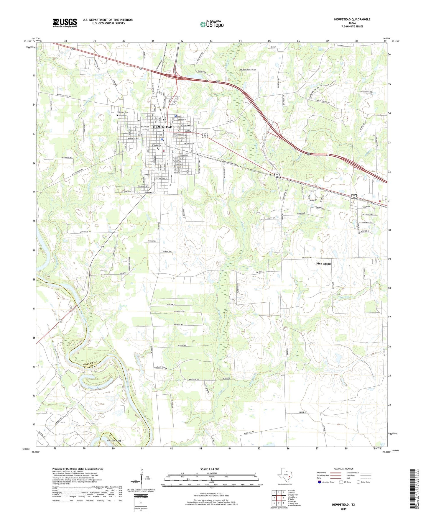
2022 topographic map quadrangle Hempstead in the state of Texas. Scale: 1:24000. Based on the newly updated USGS 7.5' US Topo map series, this map is in the following counties: Waller, Austin. The map contains contour data, water features, and other items you are used to seeing on USGS maps, but also has updated roads and other features. This is the next generation of topographic maps. Printed on high-quality waterproof paper with UV fade-resistant inks.
Quads adjacent to this one:
West: Buckhorn
Northwest: Daniels
North: Howth
Northeast: Waller NW
East: Waller
Southeast: Hockley Mound
South: Sunny Side
Southwest: Burleigh
This map covers the same area as the classic USGS quad with code o30096a1.
Contains the following named places: Brenham Cemetery, City of Hempstead, Frontier Emergency Medical Service, Greater Wyatt Chapel, Hempstead, Hempstead City Hall, Hempstead Division, Hempstead Gliderport, Hempstead High School, Hempstead Police Department, Hempstead Post Office, Hempstead Volunteer Fire Department, Lewisville, Lewisville Creek, Pine Island, Pine Island Church, Ponds Creek, Prairie View Volunteer Fire Department, Prairie View-Waller Division, Primecare Medical Services, Raccoon Bend, Raccoon Bend Oil Field, Saint Bartholomews Episcopal Church, Texas Department of Public Safety Troopers Office, Threemile Creek, Town of Pine Island, Waller County Constable's Office Precinct 1, Waller County Constable's Office Precinct 3, Waller County Courthouse, Waller County Emergency Management Services, Waller County Jail, Waller County Sheriff's Office, Waller County Volunteer Emergency Medical Service, ZIP Code: 77445