MyTopo
Hunt Texas US Topo Map
Couldn't load pickup availability
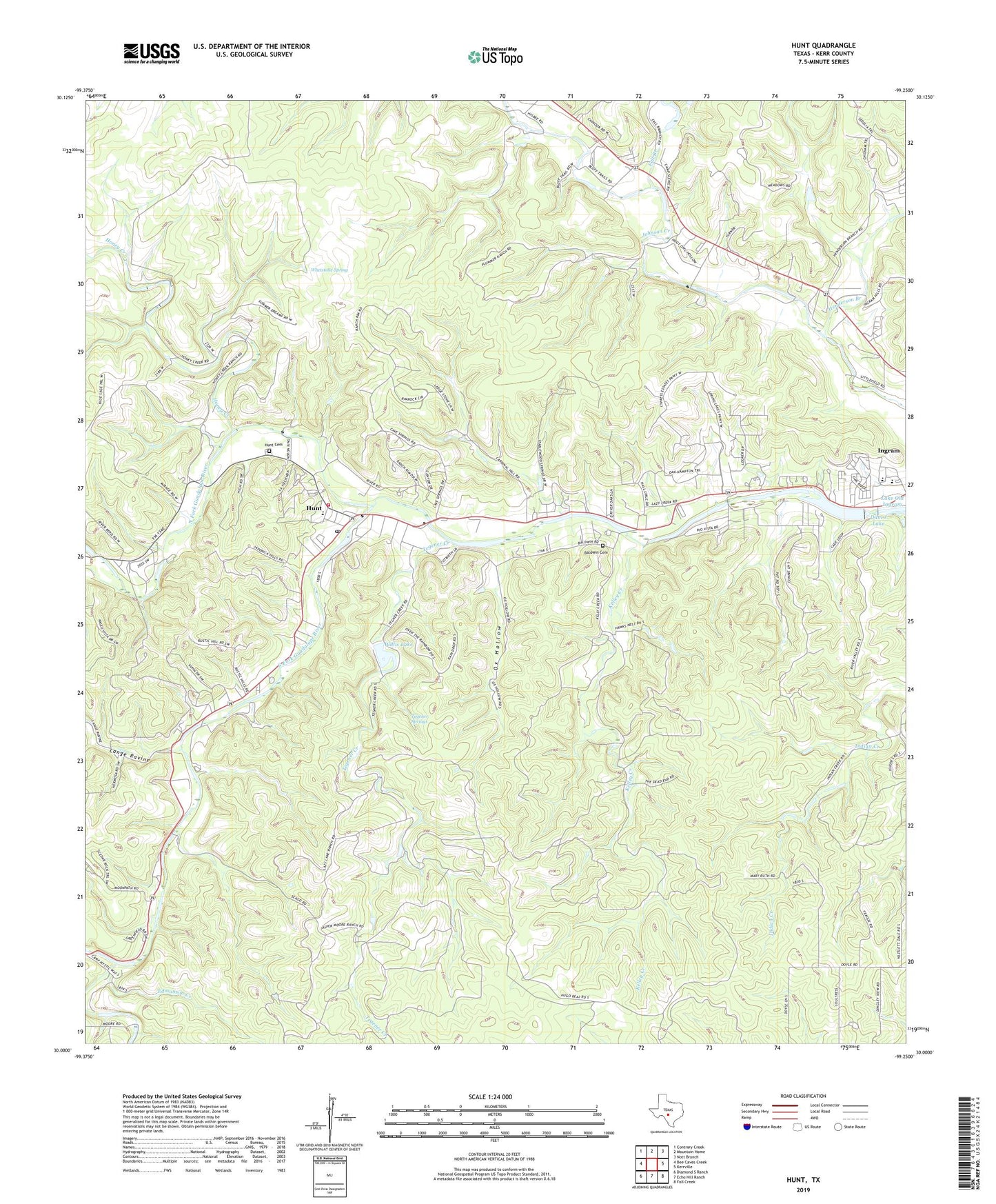
2019 topographic map quadrangle Hunt in the state of Texas. Scale: 1:24000. Based on the newly updated USGS 7.5' US Topo map series, this map is in the following counties: Kerr. The map contains contour data, water features, and other items you are used to seeing on USGS maps, but also has updated roads and other features. This is the next generation of topographic maps. Printed on high-quality waterproof paper with UV fade-resistant inks.
Quads adjacent to this one:
West: Bee Caves Creek
Northwest: Contrary Creek
North: Mountain Home
Northeast: Nott Branch
East: Kerrville
Southeast: Fall Creek
South: Echo Hill Ranch
Southwest: Diamond S Ranch
Contains the following named places: Baldwin Cemetery, Bittle Ranch, Blackburn Dam, Camp Arrowhead, Camp LaJunta, Camp Mystic, Camp Rio Vista, Camp Scenic, Camp Stewart, Conrad Meadows Ranch, Crider - Moore Cemetery, Cypress Creek, Dam J Lake, Domingues Ranch, Edmunson Creek, Fall Branch, Henderson Branch, Henderson Springs, Honey Creek, Honey Creek Ranch, Horsman Dam, Hunt, Hunt Cemetery, Hunt Post Office, Hunt Volunteer Fire Department, Indian Springs, Ingram Lake Dam, Kelley Creek, Kelly Springs, Kerr County, La Hacienda Treatment Center, Lake New Ingram, Lange Ravine, Lazy Hills Ranch, Lazy Lane Ranch, Moore Ranch, North Fork Guadalupe River, Ox Hollow, Rocky Ford Ranch, San Antonio Camp, South Fork Guadalupe River, Tegener Creek, Tegener Springs, Trails End Ranch, Waltonia, Whetstone Spring, Willis Lake, Willis Lake Dam, ZIP Code: 78025