MyTopo
Echo Hill Ranch Texas US Topo Map
Couldn't load pickup availability
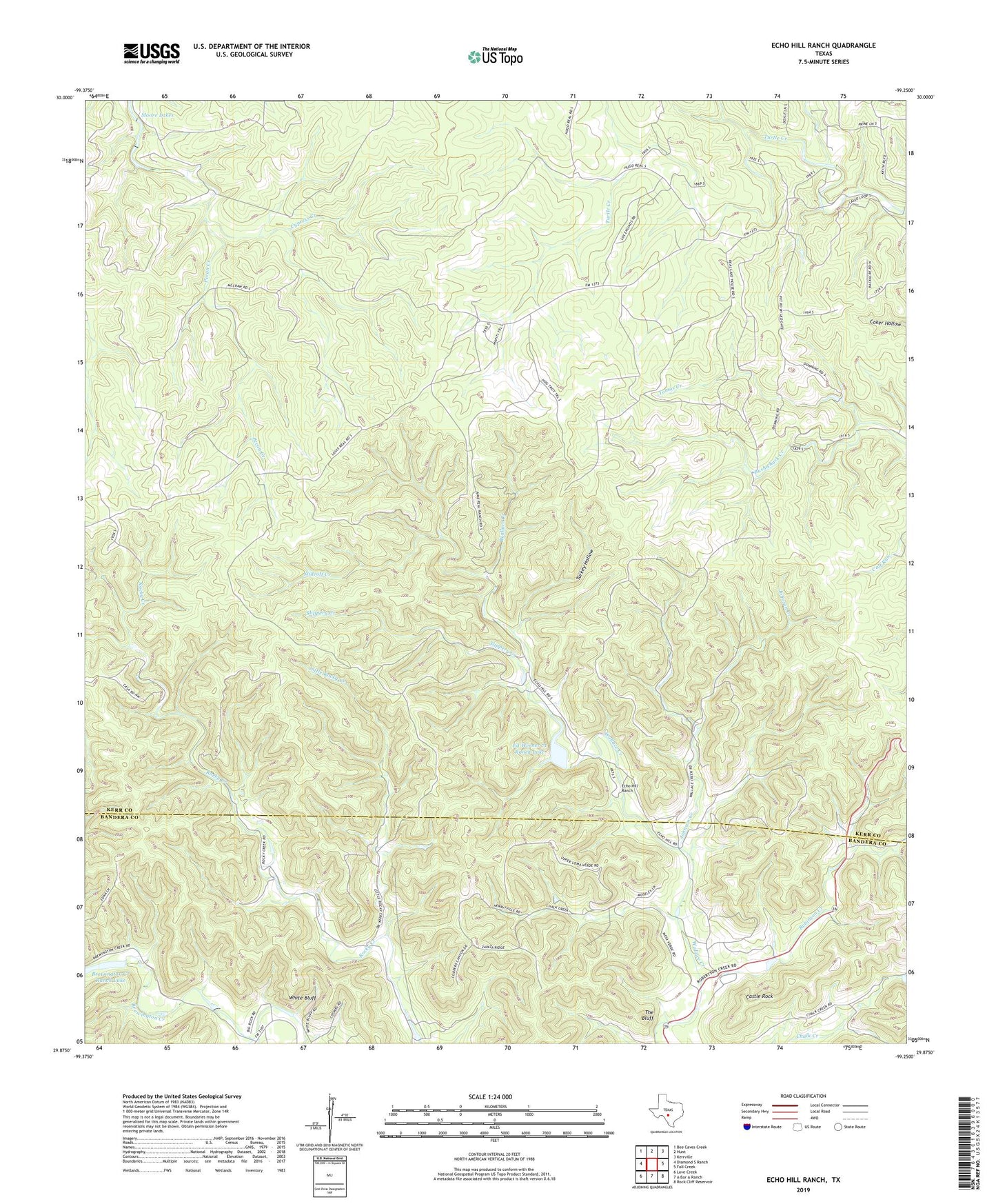
2022 topographic map quadrangle Echo Hill Ranch in the state of Texas. Scale: 1:24000. Based on the newly updated USGS 7.5' US Topo map series, this map is in the following counties: Kerr, Bandera. The map contains contour data, water features, and other items you are used to seeing on USGS maps, but also has updated roads and other features. This is the next generation of topographic maps. Printed on high-quality waterproof paper with UV fade-resistant inks.
Quads adjacent to this one:
West: Diamond S Ranch
Northwest: Bee Caves Creek
North: Hunt
Northeast: Kerrville
East: Fall Creek
Southeast: Rock Cliff Reservoir
South: A Bar A Ranch
Southwest: Love Creek
This map covers the same area as the classic USGS quad with code o29099h3.
Contains the following named places: A Real Ranch, Brewington Creek, Brewington Creek Ranch Lake, Brewington Creek Ranch Lake Dam, Castle Rock, Echo Hill Ranch, Ed Werner 71 Ranch Lake, Ed Werner 71 Ranch Lake Dam, H Real Ranch, Johnson Creek, L Real Ranch, Little Rocky Creek, Medina Childrens Home, Moore Lakes, Moore Ranch, Pecan Creek, Porter Ranch, Robinson Creek, Slideoff Creek, Slippery Creek, The Bluff, Tomas Creek, Turkey Hollow, White Bluff, White Ranch