MyTopo
Diamond S Ranch Texas US Topo Map
Couldn't load pickup availability
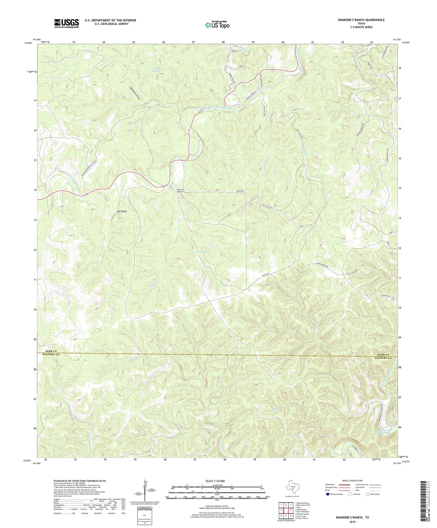
2022 topographic map quadrangle Diamond S Ranch in the state of Texas. Scale: 1:24000. Based on the newly updated USGS 7.5' US Topo map series, this map is in the following counties: Kerr, Bandera. The map contains contour data, water features, and other items you are used to seeing on USGS maps, but also has updated roads and other features. This is the next generation of topographic maps. Printed on high-quality waterproof paper with UV fade-resistant inks.
Quads adjacent to this one:
West: Well Hollow
Northwest: Boneyard Draw
North: Bee Caves Creek
Northeast: Hunt
East: Echo Hill Ranch
Southeast: A Bar A Ranch
South: Love Creek
Southwest: Sabinal Canyon
This map covers the same area as the classic USGS quad with code o29099h4.
Contains the following named places: Bee Bluff, Buffalo Creek, Coal Creek, Diamond S Ranch, Fisher Ranch, Frank Baker Creek, Green Spring, Little Brewington Creek, Lynhaven Lodge, Lynx Haven Springs, Mullen Creek, Reed Ranch, South Fork Ranch, Spur Branch, Sycamore Draw, Whitworth Ranch