MyTopo
San Pedro Ranch Texas US Topo Map
Couldn't load pickup availability
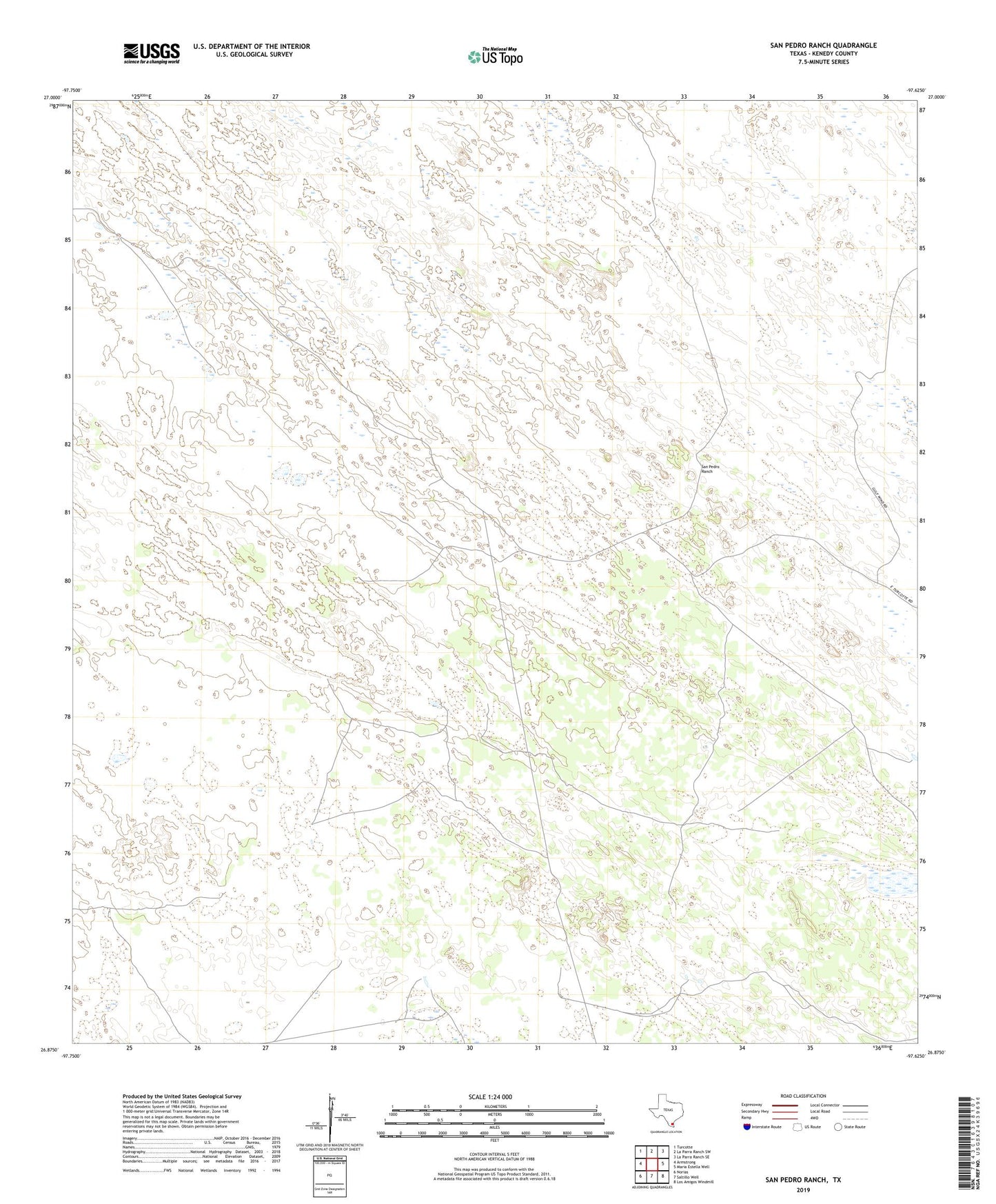
2022 topographic map quadrangle San Pedro Ranch in the state of Texas. Scale: 1:24000. Based on the newly updated USGS 7.5' US Topo map series, this map is in the following counties: Kenedy. The map contains contour data, water features, and other items you are used to seeing on USGS maps, but also has updated roads and other features. This is the next generation of topographic maps. Printed on high-quality waterproof paper with UV fade-resistant inks.
Quads adjacent to this one:
West: Armstrong
Northwest: Turcotte
North: La Parra Ranch SW
Northeast: La Parra Ranch SE
East: Maria Estella Well
Southeast: Los Amigos Windmill
South: Saltillo Well
Southwest: Norias
This map covers the same area as the classic USGS quad with code o26097h6.
Contains the following named places: Agua Dulce Well, Alazan Well, Barreta Well, Curry Well, Emes Windmill, Huisache Well, Huisache Windmill, John Well, Kenedy County, La Piedra Well, Nedo Well, Piedra Trap Windmill, Piedra Well, Potrero Number One Well, Rodeo Windmill, San Antonio Windmill, San Francisco Windmill, San Pedro Ranch, Santa Cruz Well, Sarita Division, Sordo Well, Timoteo Artesian Well, Trampas Seca Well