MyTopo
Armstrong Texas US Topo Map
Couldn't load pickup availability
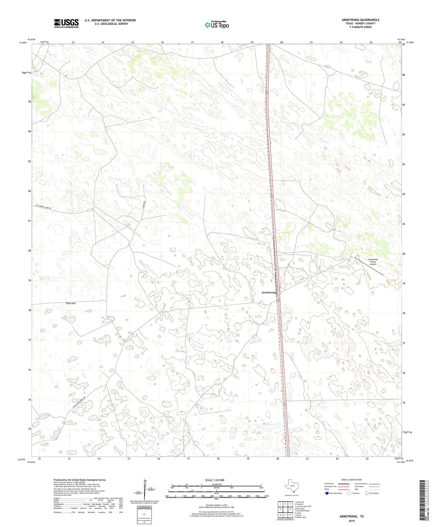
2022 topographic map quadrangle Armstrong in the state of Texas. Scale: 1:24000. Based on the newly updated USGS 7.5' US Topo map series, this map is in the following counties: Kenedy. The map contains contour data, water features, and other items you are used to seeing on USGS maps, but also has updated roads and other features. This is the next generation of topographic maps. Printed on high-quality waterproof paper with UV fade-resistant inks.
Quads adjacent to this one:
West: Pita Camp
Northwest: Sarita SW
North: Turcotte
Northeast: La Parra Ranch SW
East: San Pedro Ranch
Southeast: Saltillo Well
South: Norias
Southwest: Julian
This map covers the same area as the classic USGS quad with code o26097h7.
Contains the following named places: Anita Artesian Well, Armstrong, Armstrong Ranch Airport, Armstrong Ranch Headquarters, Comal Artesian Well, Encinitos Windmill, Enriquieta Artesian Well, Guadalupe Artesian Well, Gueras Windmill, Harbin Artesian Well, Josefina Artesian Well, Juan Perez Artesian Well, Julia Artesian Well, La Blanca Artesian Well, Lucita Artesian Well, Maleta Windmill, Marana Artesian Well, Mustania Windmill, Potrero Number Two Windmill, San Tomas Artesian Well, Santiago Artesian Well, Tecolote Windmill, Tim Artesian Well, Titi Artesian Well, Tokyo Artesian Well, Tokyo Hill, Zorilla Artesian Well, ZIP Code: 78338