MyTopo
Bertram Texas US Topo Map
Couldn't load pickup availability
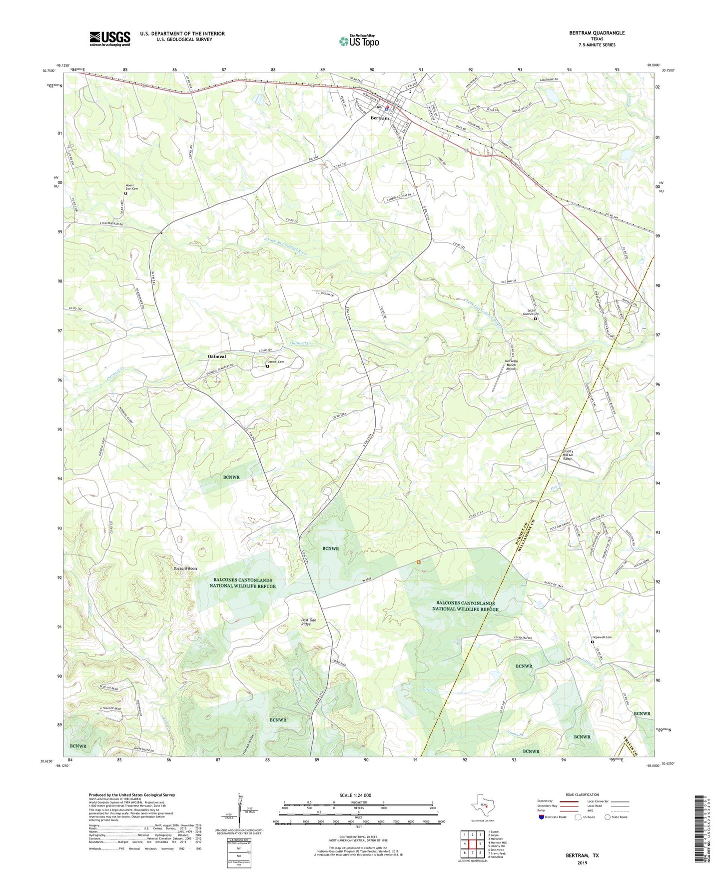
2022 topographic map quadrangle Bertram in the state of Texas. Scale: 1:24000. Based on the newly updated USGS 7.5' US Topo map series, this map is in the following counties: Burnet, Williamson, Travis. The map contains contour data, water features, and other items you are used to seeing on USGS maps, but also has updated roads and other features. This is the next generation of topographic maps. Printed on high-quality waterproof paper with UV fade-resistant inks.
Quads adjacent to this one:
West: Mormon Mill
Northwest: Burnet
North: Joppa
Northeast: Mahomet
East: Liberty Hill
Southeast: Nameless
South: Travis Peak
Southwest: Smithwick
This map covers the same area as the classic USGS quad with code o30098f1.
Contains the following named places: Bertram, Bertram City Hall, Bertram Division, Bertram Police Department, Bertram Post Office, Bertram Volunteer Fire Department, Buzzard Roost, City of Bertram, Flying X Ranch Airport, Hopewell Cemetery, Jimms Branch, Liberty Hill Air Ranch, McFarlin Ranch Airport, Mount Zion Cemetery, Mount Zion Church, Oatmeal, Oatmeal Cemetery, Oatmeal Creek, Pitts Ranch Airport, South Gabriel Cemetery