MyTopo
Travis Peak Texas US Topo Map
Couldn't load pickup availability
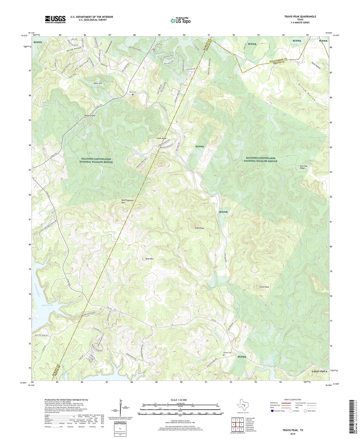
2022 topographic map quadrangle Travis Peak in the state of Texas. Scale: 1:24000. Based on the newly updated USGS 7.5' US Topo map series, this map is in the following counties: Travis, Burnet, Williamson. The map contains contour data, water features, and other items you are used to seeing on USGS maps, but also has updated roads and other features. This is the next generation of topographic maps. Printed on high-quality waterproof paper with UV fade-resistant inks.
Quads adjacent to this one:
West: Smithwick
Northwest: Mormon Mill
North: Bertram
Northeast: Liberty Hill
East: Nameless
Southeast: Mansfield Dam
South: Pace Bend
Southwest: Spicewood
This map covers the same area as the classic USGS quad with code o30098e1.
Contains the following named places: Ada Simond Creek, Balcones Canyonlands National Wildlife Refuge, Bald Mountain, Bee Creek, Boultinghouse Mountain, Chalk Knob, Chalk Knob Branch, Cottonwood Branch, Devils Hollow, Flatrock Hollow, Hansel Cemetery, Heine Cemetery, Hickory Pass, Long Hollow, Negrohead, Post Oak Creek, Post Oak Ridge, Spanish Oak Creek, Spring Branch, Spring Hollow, Sulphur Creek, Tater Hill, Travis Peak, Turkey Bend Trail