MyTopo
Lipan Texas US Topo Map
Couldn't load pickup availability
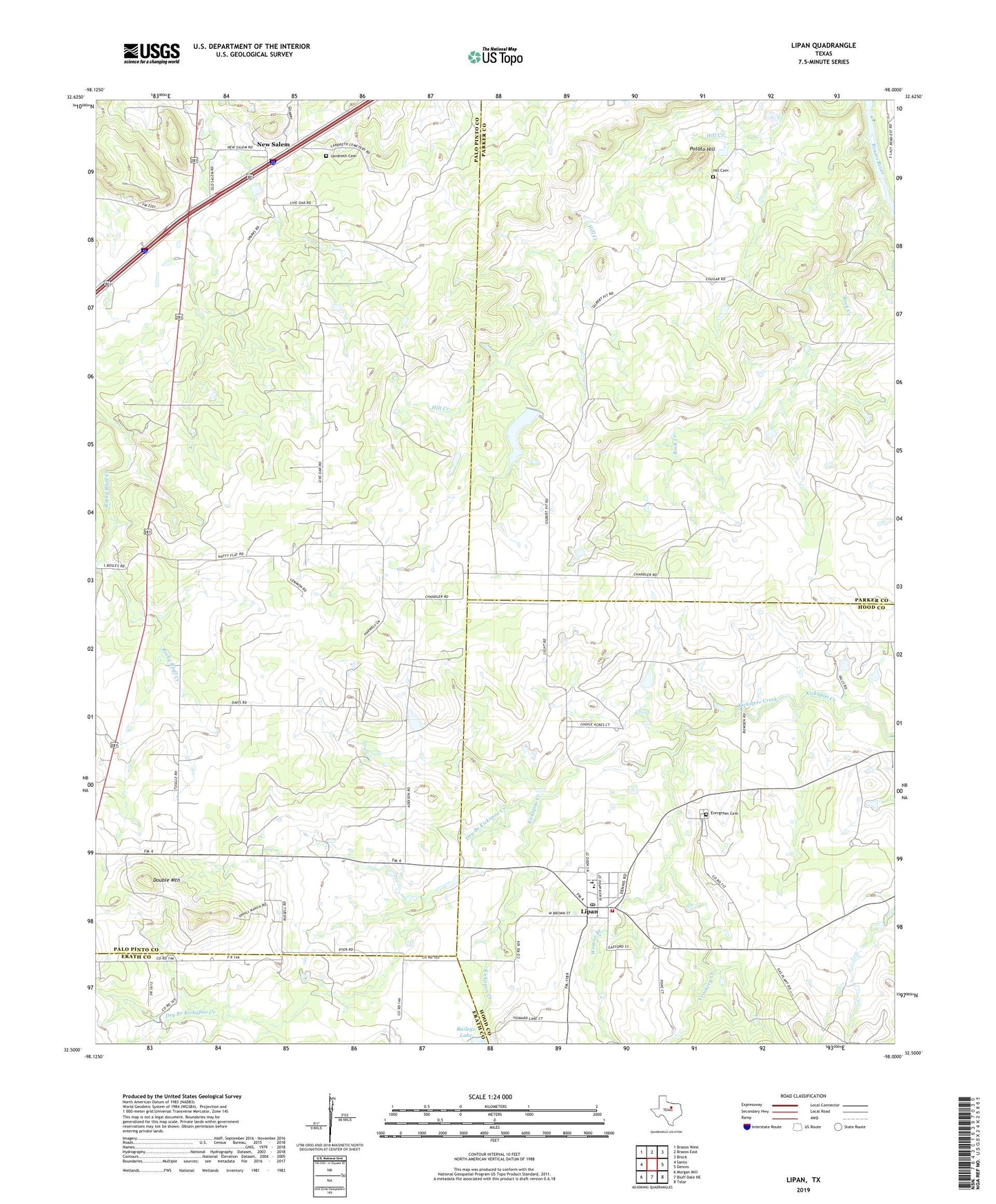
2019 topographic map quadrangle Lipan in the state of Texas. Scale: 1:24000. Based on the newly updated USGS 7.5' US Topo map series, this map is in the following counties: Palo Pinto, Parker, Hood, Erath. The map contains contour data, water features, and other items you are used to seeing on USGS maps, but also has updated roads and other features. This is the next generation of topographic maps. Printed on high-quality waterproof paper with UV fade-resistant inks.
Quads adjacent to this one:
West: Santo
Northwest: Brazos West
North: Brazos East
Northeast: Brock
East: Dennis
Southeast: Tolar
South: Bluff Dale NE
Southwest: Morgan Mill
Contains the following named places: Baileys Lake, Baileys Lake Dam, Branson Lake, Branson Lake Dam, Church of Christ, City of Lipan, Crockery Creek, Double Mountain, Dry Branch Kickapoo Creek, Evergreen Cemetery, First Baptist Church, Hill Cemetery, Landreth Cemetery, Lipan, Lipan City Hall, Lipan Elementary School, Lipan High School, Lipan Post Office, Lipan Volunteer Ambulance Service, Lipan Volunteer Fire Department, Live Oak Church, New Salem, Potato Hill, Rock Creek, Weaver Branch, ZIP Code: 76462