MyTopo
Smithers Lake Texas US Topo Map
Couldn't load pickup availability
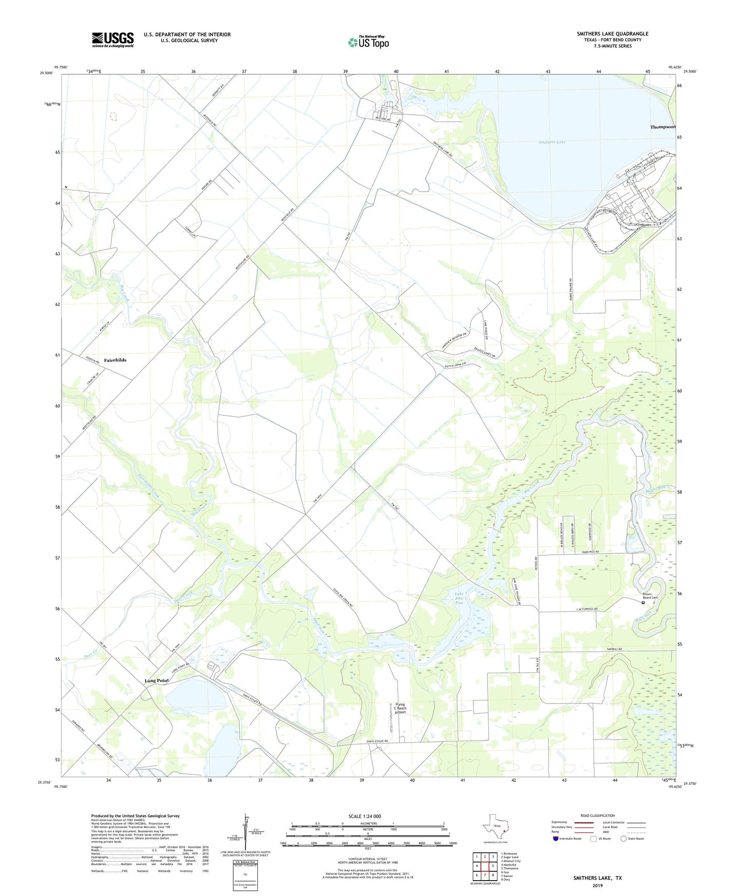
2022 topographic map quadrangle Smithers Lake in the state of Texas. Scale: 1:24000. Based on the newly updated USGS 7.5' US Topo map series, this map is in the following counties: Fort Bend. The map contains contour data, water features, and other items you are used to seeing on USGS maps, but also has updated roads and other features. This is the next generation of topographic maps. Printed on high-quality waterproof paper with UV fade-resistant inks.
Quads adjacent to this one:
West: Needville
Northwest: Richmond
North: Sugar Land
Northeast: Missouri City
East: Thompsons
Southeast: Otey
South: Damon
Southwest: Guy
This map covers the same area as the classic USGS quad with code o29095d6.
Contains the following named places: Big Creek Oil Field, Brown-Beard Cemetery, Deer Creek, Dry Creek, Fairchilds Creek, Flying C Ranch Airport, Joseph M Pound House Historical Museum, Lake George, Lake Paw Paw, Lake Paw Paw Dam, Long Point, Long Point School, Pilant Lake, Rabbs Bayou, Richmond Division, Rosenberg-Richmond Division, Smithers Lake, Smithers Lake Dam, Town of Thompsons, Whaley Corner, Worthington Lake, ZIP Code: 77469