MyTopo
Richland Springs Texas US Topo Map
Couldn't load pickup availability
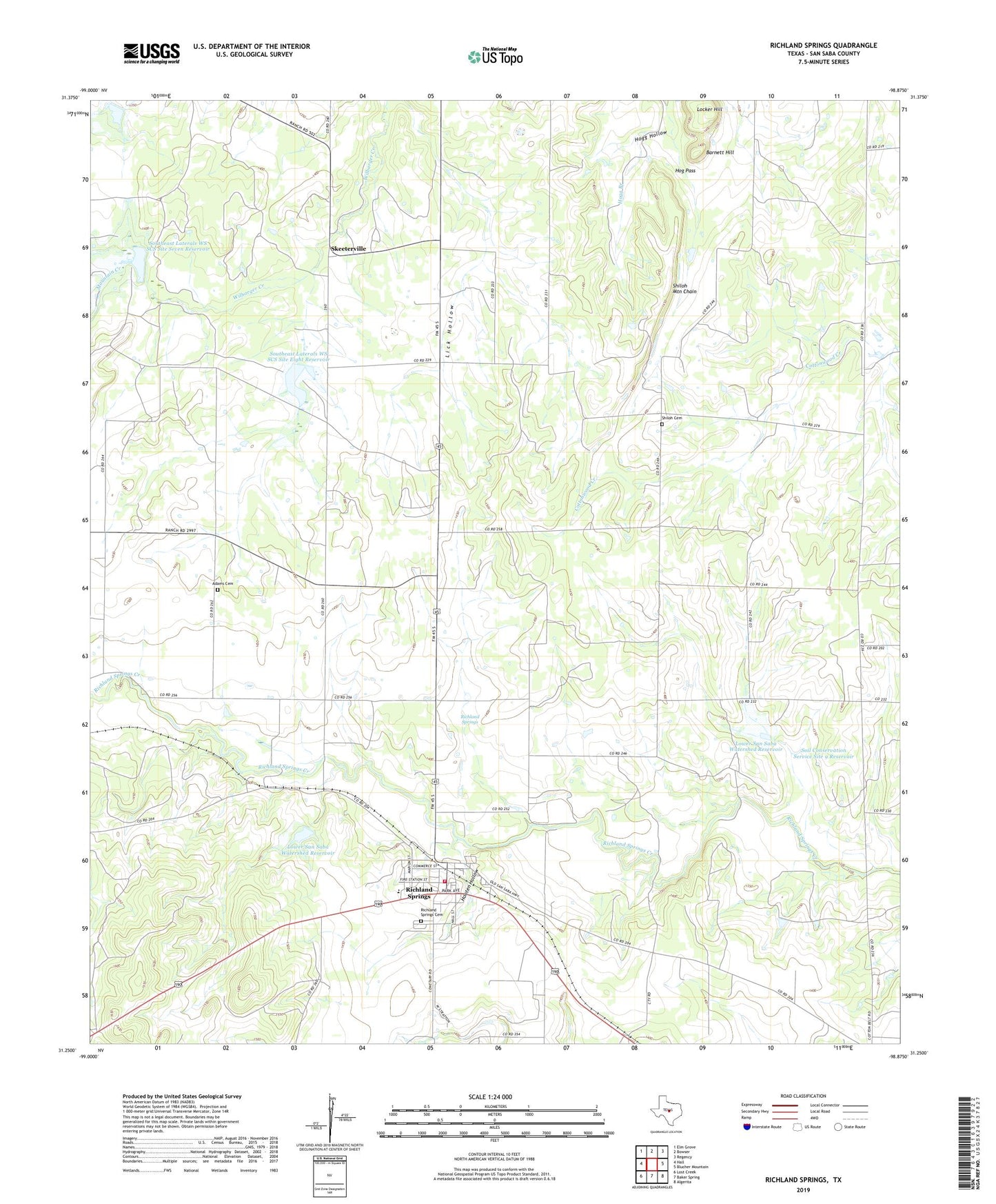
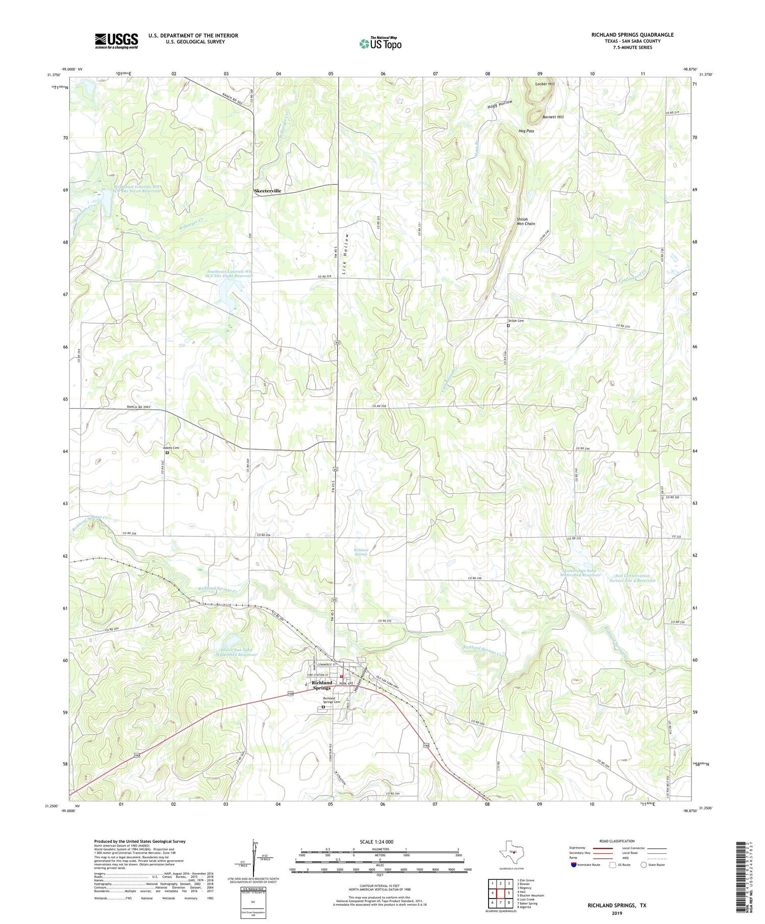
2019 topographic map quadrangle Richland Springs in the state of Texas. Scale: 1:24000. Based on the newly updated USGS 7.5' US Topo map series, this map is in the following counties: San Saba. The map contains contour data, water features, and other items you are used to seeing on USGS maps, but also has updated roads and other features. This is the next generation of topographic maps. Printed on high-quality waterproof paper with UV fade-resistant inks.
Quads adjacent to this one:
West: Hall
Northwest: Elm Grove
North: Bowser
Northeast: Regency
East: Blucher Mountain
Southeast: Algerita
South: Baker Spring
Southwest: Lost Creek
Contains the following named places: Adams Cemetery, Barnett Hill, Hog Pass, Hogg Hollow, Hooten Hollow, Lakeview Community Hall, Locker Hill, Lower San Saba Watershed Reservoir, Mountain Creek, Richland Springs, Richland Springs Cemetery, Richland Springs Post Office, Richland Springs School, Richland Springs Volunteer Fire Department, Shiloh Cemetery, Shiloh Church, Shiloh Mountain Chain, Skeeterville, Soil Conservation Service Site 7 Dam, Soil Conservation Service Site 8 Dam, Soil Conservation Service Site 8 Reservoir, Soil Conservation Service Site 8a-1 Dam, Soil Conservation Service Site 9 Dam, Soil Conservation Service Site 9 Reservoir, Southeast Laterals WS SCS Site Eight Reservoir, Southeast Laterals WS SCS Site Nine Reservoir, Southeast Laterals WS SCS Site Seven Reservoir, Town of Richland Springs, ZIP Code: 76871