MyTopo
Lytle Texas US Topo Map
Couldn't load pickup availability
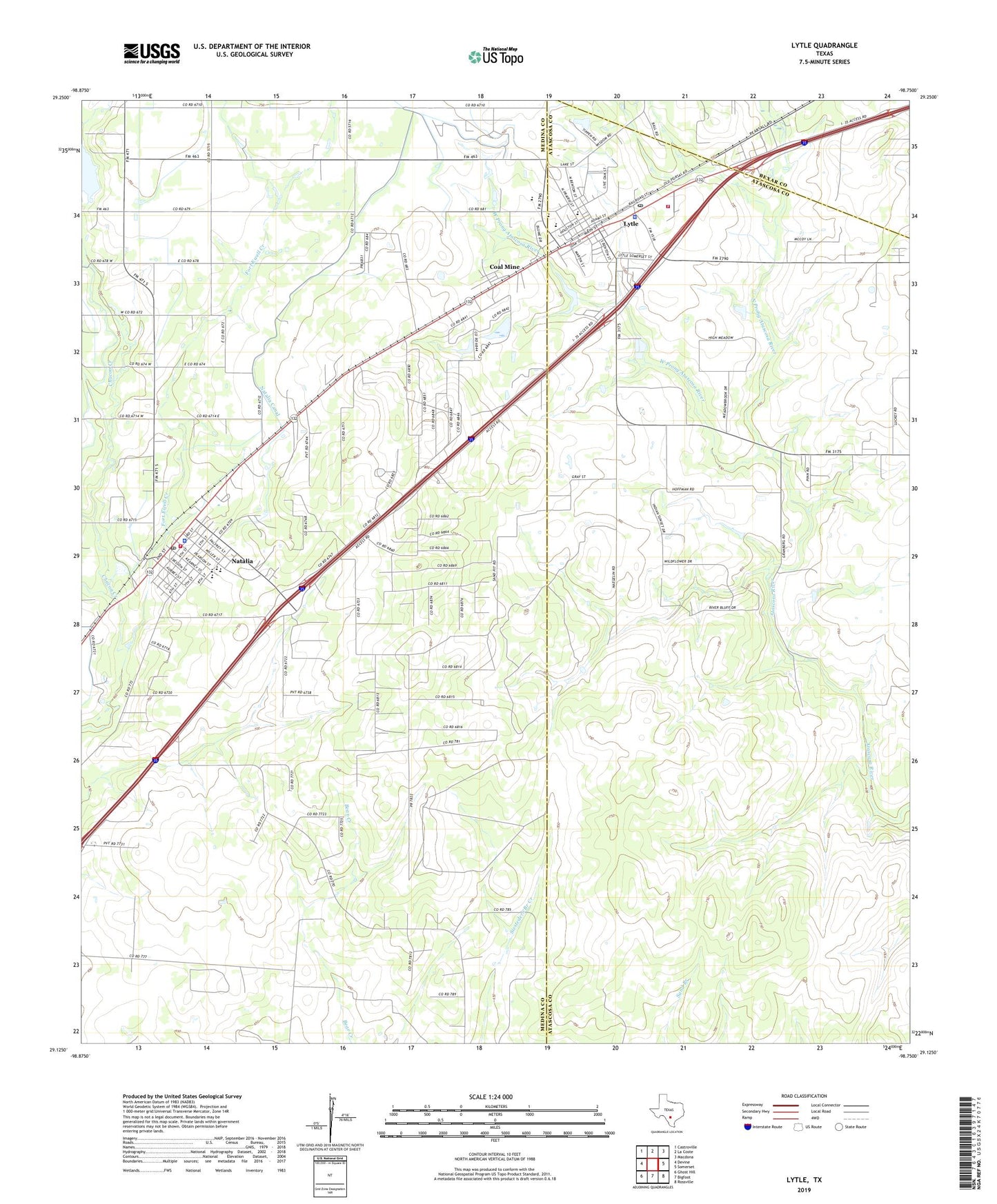
2022 topographic map quadrangle Lytle in the state of Texas. Scale: 1:24000. Based on the newly updated USGS 7.5' US Topo map series, this map is in the following counties: Medina, Atascosa, Bexar. The map contains contour data, water features, and other items you are used to seeing on USGS maps, but also has updated roads and other features. This is the next generation of topographic maps. Printed on high-quality waterproof paper with UV fade-resistant inks.
Quads adjacent to this one:
West: Devine
Northwest: Castroville
North: La Coste
Northeast: Macdona
East: Somerset
Southeast: Rossville
South: Bigfoot
Southwest: Ghost Hill
This map covers the same area as the classic USGS quad with code o29098b7.
Contains the following named places: Assembly of God Gospel Temple Church, Calvary Church, City of Lytle, City of Natalia, Coal Mine, East Prong Fort Ewell Creek, Fort Ewell Creek, Lytle, Lytle City Hall, Lytle High School, Lytle Police Department, Lytle Post Office, Lytle Volunteer Fire Department, Natalia, Natalia Canal, Natalia City Hall, Natalia Police Department, Natalia Post Office, Natalia Volunteer Fire Department, North Prong Atascosa River, Pilgrim Dam, Pilgrim Lake, Twin Lake Estates-East Lake Dam, Twin Lake Estates-West Lake Dam, Verna-Anacacho Oil Field, West Prong Atascosa River, West Prong Fort Ewell Creek, ZIP Codes: 78052, 78059