
MyTopo
Bigfoot Texas US Topo Map
Couldn't load pickup availability
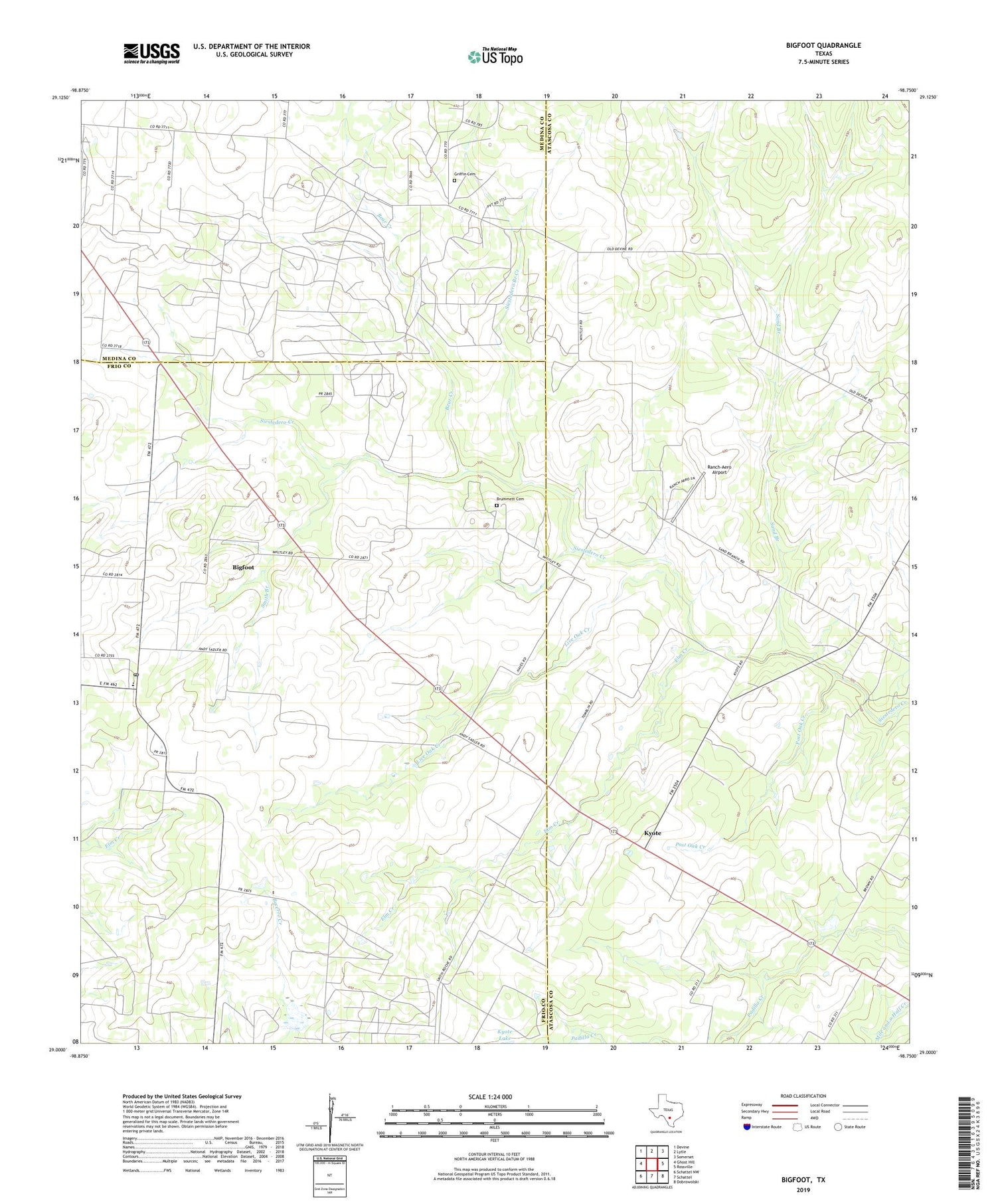
2022 topographic map quadrangle Bigfoot in the state of Texas. Scale: 1:24000. Based on the newly updated USGS 7.5' US Topo map series, this map is in the following counties: Atascosa, Frio, Medina. The map contains contour data, water features, and other items you are used to seeing on USGS maps, but also has updated roads and other features. This is the next generation of topographic maps. Printed on high-quality waterproof paper with UV fade-resistant inks.
Quads adjacent to this one:
West: Ghost Hill
Northwest: Devine
North: Lytle
Northeast: Somerset
East: Rossville
Southeast: Dobrowolski
South: Schattel
Southwest: Schattel NW
This map covers the same area as the classic USGS quad with code o29098a7.
Contains the following named places: Bear Creek, Bear Creek Oil Field, Big Foot Colonia, Big Foot Wallace Museum, Bigfoot, Bigfoot Census Designated Place, Bigfoot Post Office, Brummett Cemetery, Elm Creek, Griffin Cemetery, Kyote, Live Oak Creek, Post Oak Creek, Ranch-Aero Airport, Sand Branch, Sand Branch Church, Siestedero Branch Creek, Smith Branch, Vincent Lake, Vincent Lake Dam


