MyTopo
Somerset Texas US Topo Map
Couldn't load pickup availability
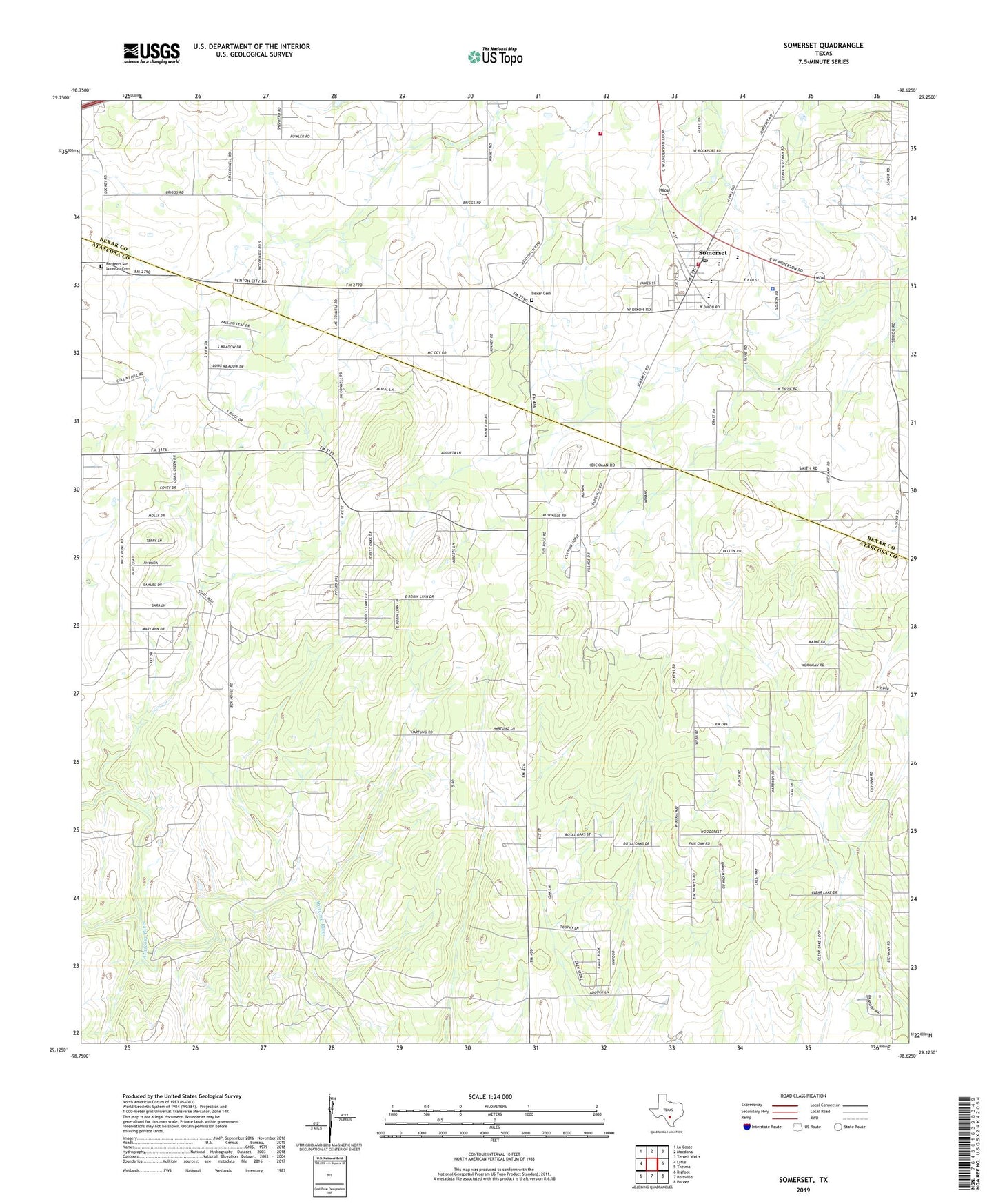
2022 topographic map quadrangle Somerset in the state of Texas. Scale: 1:24000. Based on the newly updated USGS 7.5' US Topo map series, this map is in the following counties: Atascosa, Bexar. The map contains contour data, water features, and other items you are used to seeing on USGS maps, but also has updated roads and other features. This is the next generation of topographic maps. Printed on high-quality waterproof paper with UV fade-resistant inks.
Quads adjacent to this one:
West: Lytle
Northwest: La Coste
North: Macdona
Northeast: Terrell Wells
East: Thelma
Southeast: Poteet
South: Rossville
Southwest: Bigfoot
This map covers the same area as the classic USGS quad with code o29098b6.
Contains the following named places: Bexar, Bexar Cemetery, City of Somerset, Jarret Fire and Rescue, KCHG-AM (Somerset), KXPZ-FM (Lytle), Old Rock Church, Panteon San Lorenzo Cemetery, Somerset, Somerset Elementary School, Somerset Intermediate School, Somerset Junior High School, Somerset Oil Field, Somerset Police Department, Somerset Post Office, Somerset Stadium, Somerset Volunteer Fire Department, ZIP Code: 78069