MyTopo
Love Creek Texas US Topo Map
Couldn't load pickup availability
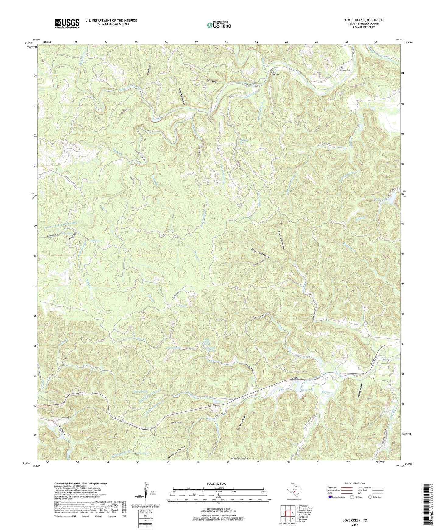
2022 topographic map quadrangle Love Creek in the state of Texas. Scale: 1:24000. Based on the newly updated USGS 7.5' US Topo map series, this map is in the following counties: Bandera. The map contains contour data, water features, and other items you are used to seeing on USGS maps, but also has updated roads and other features. This is the next generation of topographic maps. Printed on high-quality waterproof paper with UV fade-resistant inks.
Quads adjacent to this one:
West: Sabinal Canyon
Northwest: Well Hollow
North: Diamond S Ranch
Northeast: Echo Hill Ranch
East: A Bar A Ranch
Southeast: Tarpley
South: Seco Pass
Southwest: Vanderpool
This map covers the same area as the classic USGS quad with code o29099g4.
Contains the following named places: Adams Cemetery, Anderson Hollow, Big Armidge Creek, Bluff Spring, Board Tree Hollow, Bottle Springs Creek, Buckelew Creek, Chimney Hollow, Clark Creek, Coal Creek, Cold Hollow, Copperhead Hollow, Covy Hollow, Devils Bathtub Spring, Dockery Creek, Dripping Spring, Dryden Creek, Duncan Creek, Duncan Spring, Elam Creek, Freedom Hollow, Hillman Cemetery, Honey Creek, Honey Creek Cemetery, Honey Creek Ranch, Indian Hollow, Jackson Creek, Johnson Lake, Johnson Lake Dam, Johnson Ranch Airport, Left Hand Duncan Creek, Left Hand Horse Creek, Light Creek, Lin Hollow, Little Armidge Creek, Little Shephard Creek, Love Creek, Main Spring, Medina Division, Muskhog Spring, Ranger Creek, Raven Roost Hollow, Right Hand Duncan Creek, Right Hand Horse Creek, Rock Chimney Ranch, Shephard Creek, Slaughter Hollow, South Fork North Prong Medina River, Tatum Lake, Tatum Lake Dam, Tuff, Ubanks Creek, Walnut Spring, Willow Spring, Wyatt Creek