MyTopo
San Isidro Texas US Topo Map
Couldn't load pickup availability
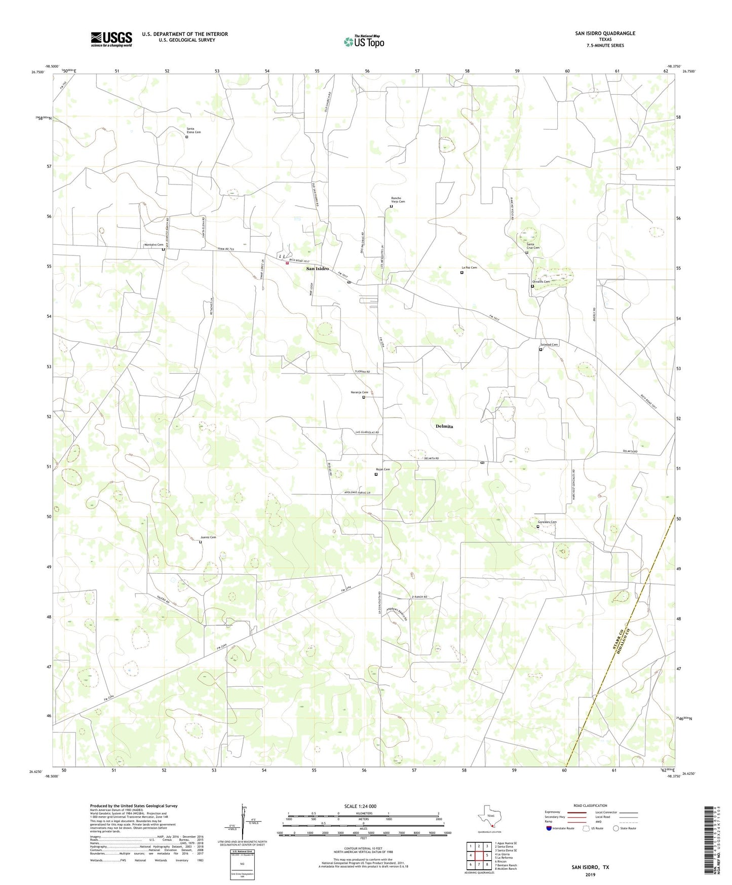
2022 topographic map quadrangle San Isidro in the state of Texas. Scale: 1:24000. Based on the newly updated USGS 7.5' US Topo map series, this map is in the following counties: Starr, Hidalgo. The map contains contour data, water features, and other items you are used to seeing on USGS maps, but also has updated roads and other features. This is the next generation of topographic maps. Printed on high-quality waterproof paper with UV fade-resistant inks.
Quads adjacent to this one:
West: La Gloria
Northwest: Agua Nueva SE
North: Santa Elena
Northeast: Santa Elena SE
East: La Reforma
Southeast: McAllen Ranch
South: Bentsen Ranch
Southwest: Rincon
This map covers the same area as the classic USGS quad with code o26098f4.
Contains the following named places: Arkansas City, Chapote Well, Delmita, Delmita Census Designated Place, Delmita Post Office, El Centro, El Salado Windmill, Gloria Colonia, Gonzales Cemetery, Juarez Cemetery, La Paz Cemetery, La Reforma Oil and Gas Field, La Taca Windmill, Montalvo Cemetery, Naranja Cemetery, North Sun Oil Field, Old Santa Elena, Olivares Cemetery, Papalote Blanco Windmill, Papalote Guajolota Windmill, Rancho Viejo Cemetery, Rojas Cemetery, San Isidro, San Isidro Census Designated Place, San Isidro Elementary School, San Isidro Fire Department, San Isidro High School, San Isidro Post Office, Santa Cruz Cemetery, Santa Elena Cemetery, Soledad Cemetery, Sun Oil Field, ZIP Codes: 78536, 78588