MyTopo
Bee Cave Texas US Topo Map
Couldn't load pickup availability
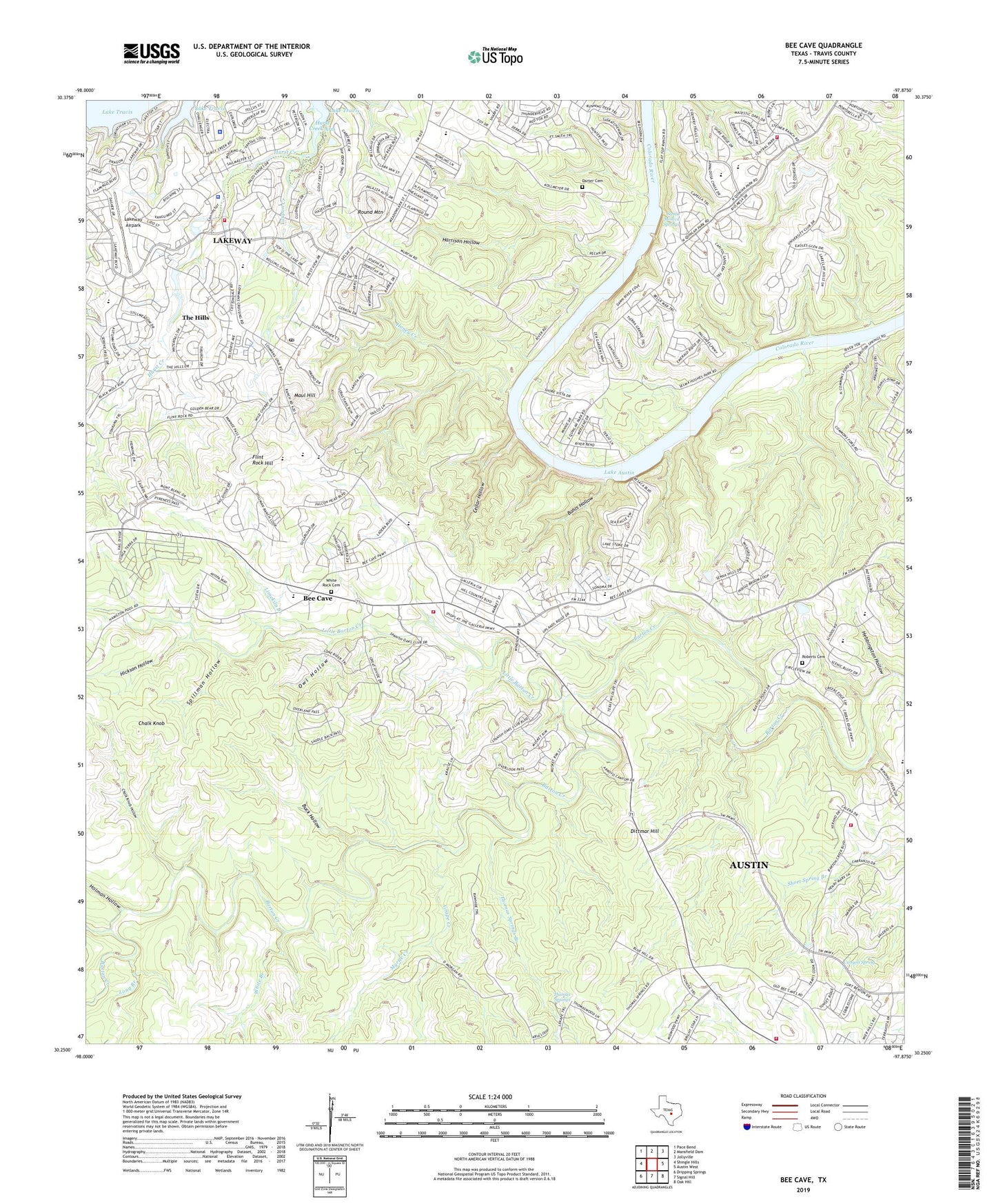
2022 topographic map quadrangle Bee Cave in the state of Texas. Scale: 1:24000. Based on the newly updated USGS 7.5' US Topo map series, this map is in the following counties: Travis. The map contains contour data, water features, and other items you are used to seeing on USGS maps, but also has updated roads and other features. This is the next generation of topographic maps. Printed on high-quality waterproof paper with UV fade-resistant inks.
Quads adjacent to this one:
West: Shingle Hills
Northwest: Pace Bend
North: Mansfield Dam
Northeast: Jollyville
East: Austin West
Southeast: Oak Hill
South: Signal Hill
Southwest: Dripping Springs
This map covers the same area as the classic USGS quad with code o30097c8.
Contains the following named places: Austin - Travis County Emergency Medical Service - Medic 09, Austin Fire Department Station 37, Bee Cave, Bee Caves Baptist Church, Bohls Hollow, Buck Hollow, Canyon Spring, Cavalier Stadium at Lake Travis, Cedar Hollow, Central Texas Missions, Chalk Knob, Chalk Knob Hollow, City of Bee Cave, City of Lakeway, Darter Cemetery, Dittmar Hill, Emmaus Catholic Church, First Church of Christ Scientist, Flint Rock Hill, Grape Creek, Hamilton Pool Nature Trail, Harrison Hollow, Hebbingston Hollow, Hickson Hollow, Holman Hollow, Honey Creek, Hudson Bend Middle School, Hurst Creek, Iranian Christian Church of the Central United States, Lake Hills Congregational Church, Lake Pointe Elementary School, Lake Travis Community Library, Lake Travis Elementary School, Lake Travis High School, Lake Travis Middle School, Lake Travis Post Office, Lakeland Park, Lakeway, Lakeway Airpark, Lakeway City Hall, Lakeway Elementary School, Lakeway Police Department, Limekiln Branch, Little Barton Creek, Lohmans Crossing Shopping Center, Long Branch, Mary Quinlan Park, Maul Hill, Myrtle Creek, Owl Hollow, Panorama Ranch, Pecan Grove Trail, Roberts Cemetery, Rocky Creek, Round Mountain, Saint Andrews Episcopal Upper School Football Field, Saint Christophers Episcopal Church, Santa Monica Springs, Selma Hughes Park, Shield Ranch, Spillman Hollow, Steiner Ranch Census Designated Place, The Church of Jesus Christ of Latter Day Saints, The Hills, The Hills Village Offices, Thomas Springs, Thomas Springs Branch, Trading Post, Travis County Constable's Office Precinct 3, Travis County Emergency Services District 3 Station 2 Oak Hill, Travis County Emergency Services District 6 Station 2 Lakeway, Travis County Emergency Services District 6 Station 3 Bee Cave, Travis County Emergency Services District 6 Station 5 Steiner Ranch, Village of The Hills, Waterfall Trail, West Ridge Middle School, White Branch, White Rock Cemetery, Yaupon Creek, ZIP Codes: 78733, 78736, 78738