MyTopo
Stonewall Texas US Topo Map
Couldn't load pickup availability
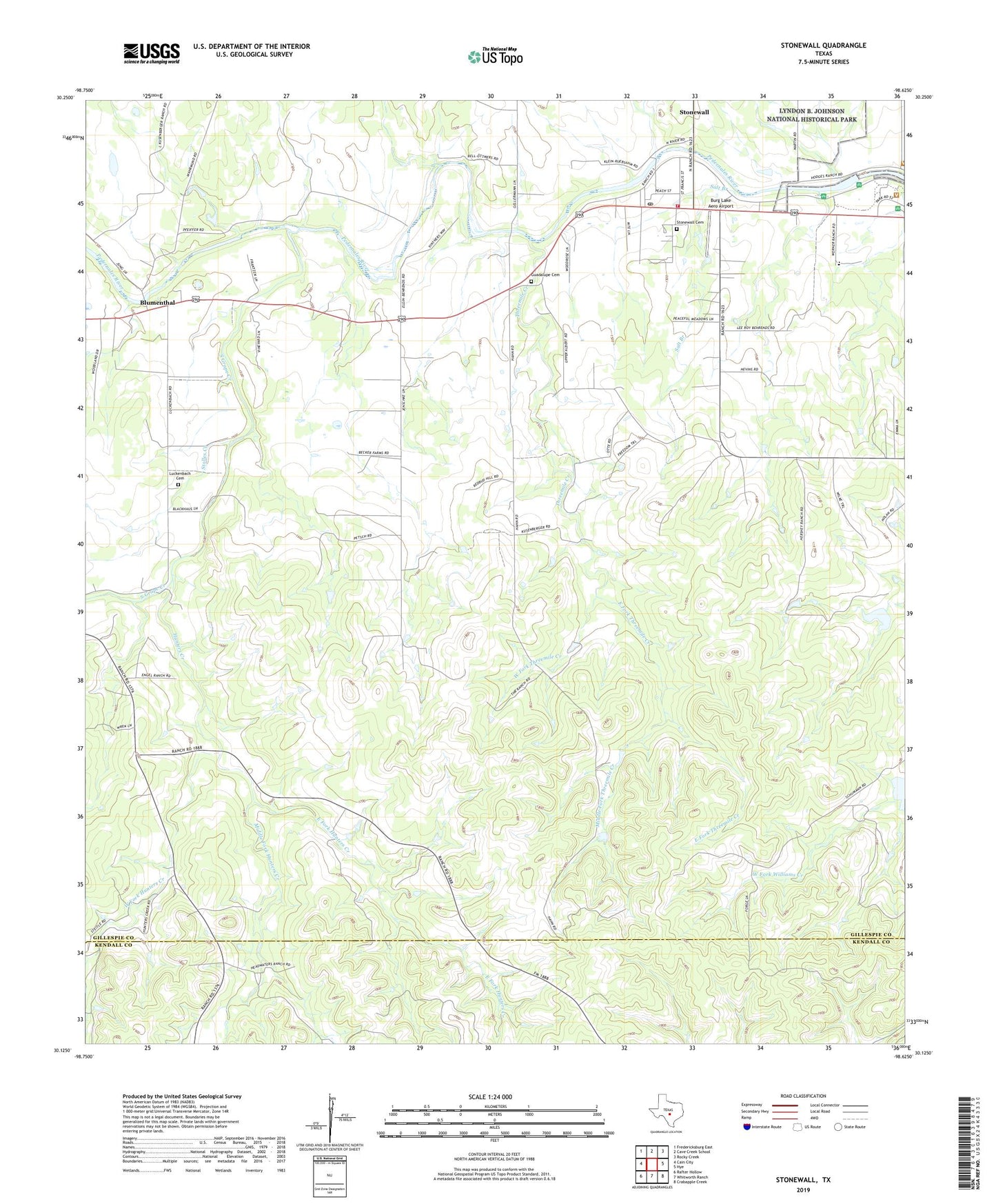
2022 topographic map quadrangle Stonewall in the state of Texas. Scale: 1:24000. Based on the newly updated USGS 7.5' US Topo map series, this map is in the following counties: Gillespie, Kendall. The map contains contour data, water features, and other items you are used to seeing on USGS maps, but also has updated roads and other features. This is the next generation of topographic maps. Printed on high-quality waterproof paper with UV fade-resistant inks.
Quads adjacent to this one:
West: Cain City
Northwest: Fredericksburg East
North: Cave Creek School
Northeast: Rocky Creek
East: Hye
Southeast: Crabapple Creek
South: Whitworth Ranch
Southwest: Rafter Hollow
This map covers the same area as the classic USGS quad with code o30098b6.
Contains the following named places: Arhelger Ranch, Blumenthal, Brehmer Ranch, Burg Lake Aero Airport, Cave Creek, Danz Ranch, East Fork Hunters Creek, East Fork Threemile Creek, Franz Ranch, Gellermann Ranch, Guadalupe Cemetery, Hopfs Creek, Hunters Creek, KFAN-FM (Johnson City), Luckenbach Cemetery, Lyndon B Johnson State Park Dam, Lyndon B Johnson State Park Lake, Lyndon Baines Johnson State Historical Park, Merz Ranch, Middle Fork Hunters Creek, Middle Fork Threemile Creek, Ottmers Ranch, Petsch Ranch, Saint Francis Xavier Church, Salt Branch, Schladoer Ranch, Soil Conservation Service Site 3 Dam, Soil Conservation Service Site 3 Reservoir, Soil Conservation Service Site 4 Dam, Soil Conservation Service Site 4 Reservoir, South Grape Creek, South Grape Creek School, Stolles Creek, Stonewall, Stonewall Cemetery, Stonewall Census Designated Place, Stonewall Post Office, Stonewall Volunteer Fire Department, Threemile Creek, Wehmeyer Ranch, Weinheimer Ranch, West Fork Hunters Creek, West Fork Threemile Creek, ZIP Code: 78671