MyTopo
Thornberry Texas US Topo Map
Couldn't load pickup availability
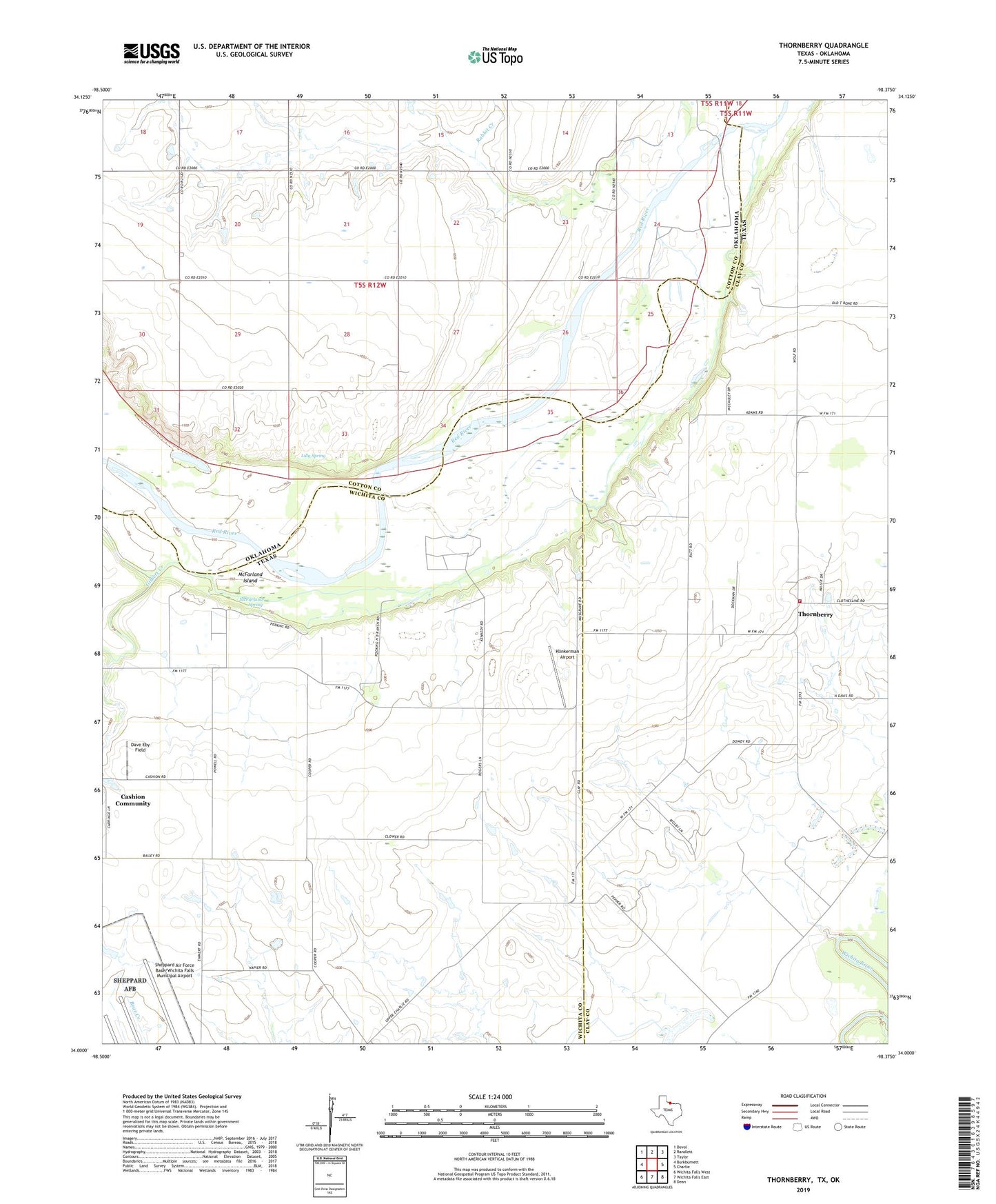
2022 topographic map quadrangle Thornberry in the states of Texas, Oklahoma. Scale: 1:24000. Based on the newly updated USGS 7.5' US Topo map series, this map is in the following counties: Wichita, Clay, Cotton. The map contains contour data, water features, and other items you are used to seeing on USGS maps, but also has updated roads and other features. This is the next generation of topographic maps. Printed on high-quality waterproof paper with UV fade-resistant inks.
Quads adjacent to this one:
West: Burkburnett
Northwest: Devol
North: Randlett
Northeast: Taylor
East: Charlie
Southeast: Dean
South: Wichita Falls East
Southwest: Wichita Falls West
This map covers the same area as the classic USGS quad with code o34098a4.
Contains the following named places: Buntons Field, Burkburnett Water Supply, Charlie Thornberry Volunteer Fire Department, Dave Eby Field, Gifford-Hill Lake, Gifford-Hill Lake Dam, Gilbert Creek, Klinkerman Airport, Lilly Spring, McFarland Island, McFarland Spring, Oknoname 033005 Dam, Oknoname 033005 Reservoir, Perkins Reservation, Randlett Water Supply, Thornberry, Thornberry Oil Field, ZIP Code: 76305