MyTopo
Llano North Texas US Topo Map
Couldn't load pickup availability
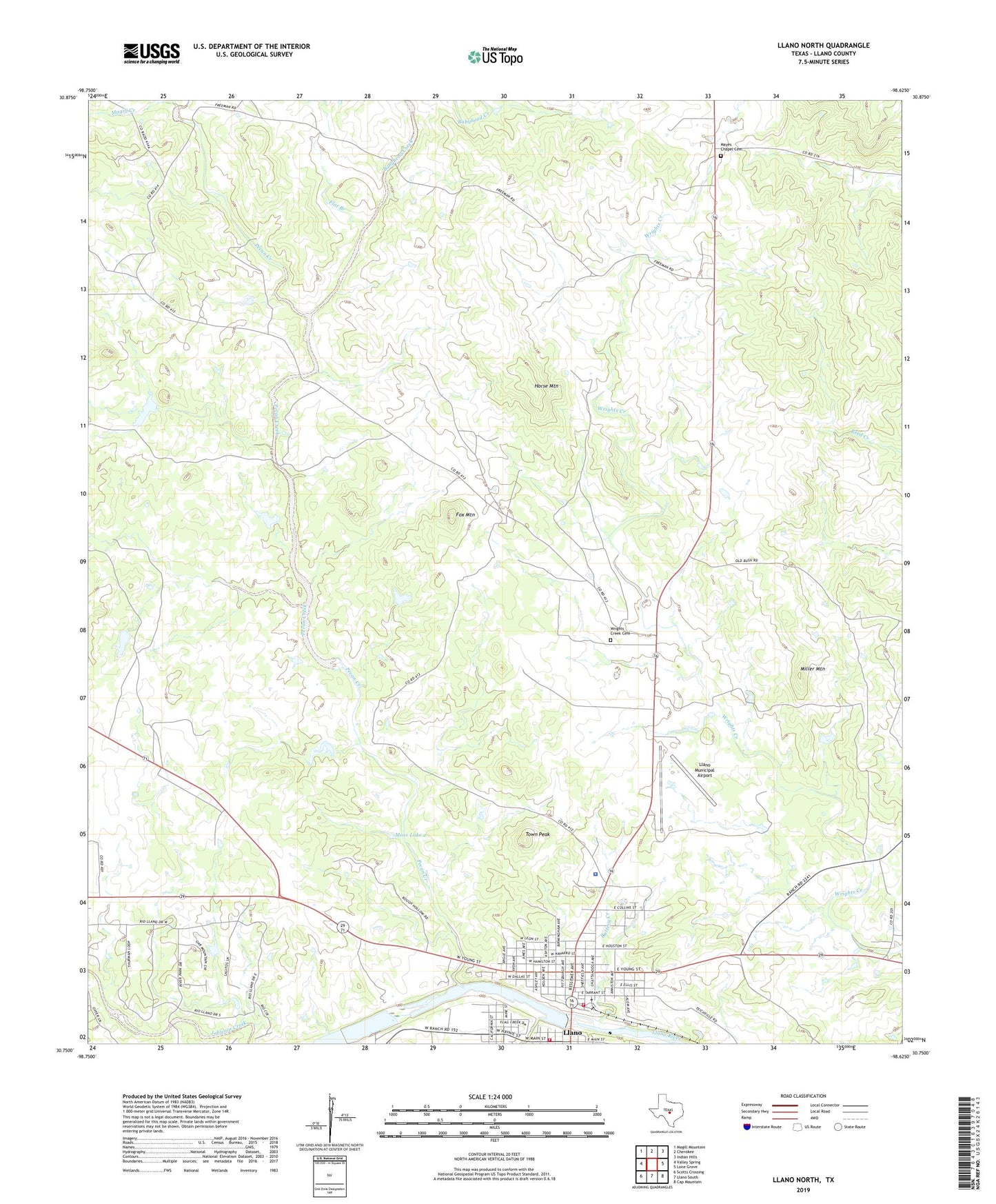
2022 topographic map quadrangle Llano North in the state of Texas. Scale: 1:24000. Based on the newly updated USGS 7.5' US Topo map series, this map is in the following counties: Llano. The map contains contour data, water features, and other items you are used to seeing on USGS maps, but also has updated roads and other features. This is the next generation of topographic maps. Printed on high-quality waterproof paper with UV fade-resistant inks.
Quads adjacent to this one:
West: Valley Spring
Northwest: Magill Mountain
North: Cherokee
Northeast: Indian Hills
East: Lone Grove
Southeast: Cap Mountain
South: Llano South
Southwest: Scotts Crossing
This map covers the same area as the classic USGS quad with code o30098g6.
Contains the following named places: Babyhead Creek, Badu Building, Buttery Creek, City of Llano, Flag Creek, Flat Branch, Fox Mountain, Hill Country Wildlife Museum, Holy Trinity Catholic Church, Horse Mountain, Lan - Tex Theater, Llano, Llano City Hall, Llano City Lake, Llano County Constable's Office Precinct 4, Llano County Courthouse, Llano County Courthouse Historic District, Llano County Museum, Llano County Sheriff's Office, Llano Municipal Airport, Llano North Division, Llano Park Dam, Llano Park Lake, Llano Police Department, Llano River Dam, Llano River Lake, Llano Volunteer Fire Department Station 1, Llano Volunteer Fire Department Station 2, Magill Creek, Mayes Chapel Cemetery, Miller Mountain, Moss Dam 2, Moss Lake 2, Pecan Creek, Southern Hotel, Town Peak, United Methodist Church, Wrights Creek Cemetery