MyTopo
Llano South Texas US Topo Map
Couldn't load pickup availability
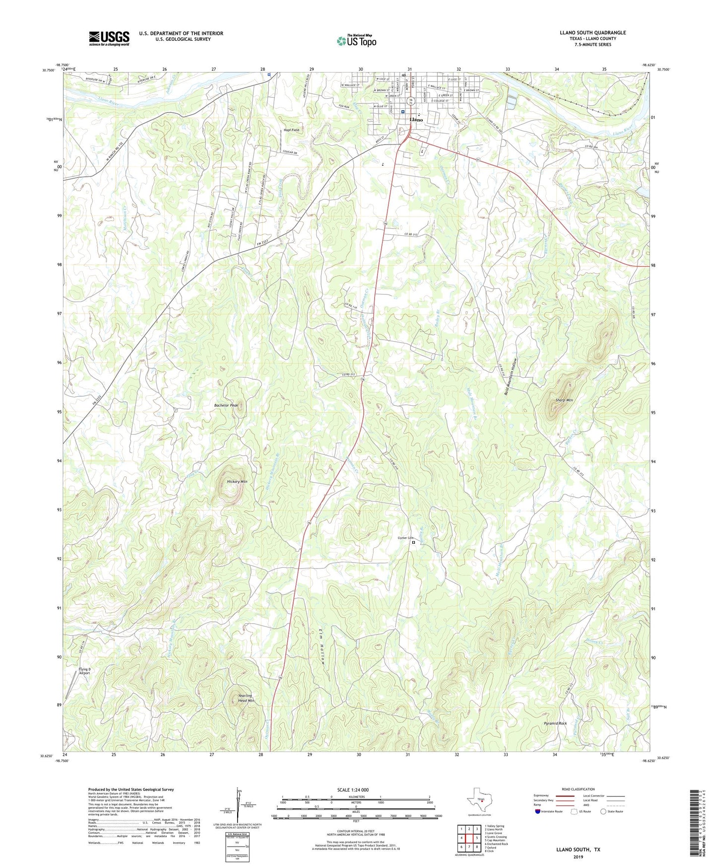
2022 topographic map quadrangle Llano South in the state of Texas. Scale: 1:24000. Based on the newly updated USGS 7.5' US Topo map series, this map is in the following counties: Llano. The map contains contour data, water features, and other items you are used to seeing on USGS maps, but also has updated roads and other features. This is the next generation of topographic maps. Printed on high-quality waterproof paper with UV fade-resistant inks.
Quads adjacent to this one:
West: Scotts Crossing
Northwest: Valley Spring
North: Llano North
Northeast: Lone Grove
East: Cap Mountain
Southeast: Click
South: Oxford
Southwest: Enchanted Rock
This map covers the same area as the classic USGS quad with code o30098f6.
Contains the following named places: Bachelor Peak, Bailey Branch, Bald Mountain Hollow, Baylor Scott and White Medical Center - Llano, Byrnes Creek, Clymer Cemetery, Elm Hollow, First Presbyterian Church, Flying D Airport, Grace Episcopal Church, Hickory Mountain, Hickory Mountain Branch, Hopf Field, Johnson Creek, Llano City Park, Llano County, Llano County Emergency Medical Service, Llano Elementary School, Llano High School, Llano Junior High School, Llano Post Office, Marchison Creek, Mule Mountain Branch, Oatman Creek, Oatman Creek Church, Pyramid Creek, Pyramid Rock, Saint James Lutheran Church, Salt Branch, Sharp Mountain, Yearling Head Mountain, ZIP Code: 78643