MyTopo
Kolob Reservoir Utah US Topo Map
Couldn't load pickup availability
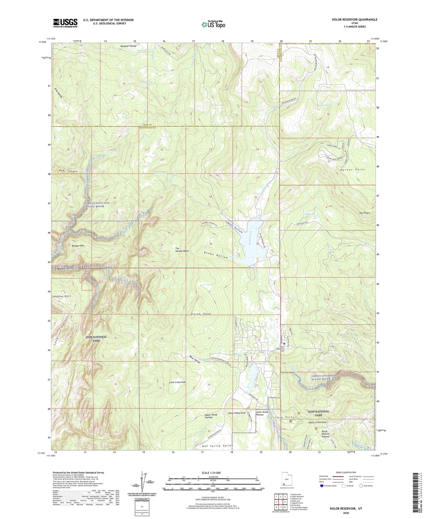
2023 topographic map quadrangle Kolob Reservoir in the state of Utah. Scale: 1:24000. Based on the newly updated USGS 7.5' US Topo map series, this map is in the following counties: Washington, Iron. The map contains contour data, water features, and other items you are used to seeing on USGS maps, but also has updated roads and other features. This is the next generation of topographic maps. Printed on high-quality waterproof paper with UV fade-resistant inks.
Quads adjacent to this one:
West: Kolob Arch
Northwest: Kanarraville
North: Cedar Mountain
Northeast: Webster Flat
East: Cogswell Point
Southeast: Temple of Sinawava
South: The Guardian Angels
Southwest: Smith Mesa
This map covers the same area as the classic USGS quad with code o37113d1.
Contains the following named places: Bear Canyon, Bear Creek, Bear Valley, Beartrap Canyon Wilderness, Beebe Hollow, Birch Spring, Blue Springs, Blue Springs Reservoir, Blue Springs Reservoir Dam, Bullpen Mountain, Chasm Lake, Goose Creek Knoll, Home Valley Knoll, Hornet Point, House Spring, Indian Hollow, KGSU-FM (Cedar City), Kolob Creek Dam, Kolob Mountain Cemetery, Kolob Peak, Kolob Reservoir, Lamareau Ranch, Langston Mountain, Lava Point, Lava Point Campground, LaVerkin Creek Wilderness, Little Creek Peak, Long Point, Lower Kolob Plateau, Meadow Hollow, Meadow Hollow Dam, Meadow Hollow Reservoir, Mud Spring, Oak Spring, Pine Hollow, Sevy Ranch, Spillsbury Ranch, Spring Creek Ditch, The Hardscrabble, The Pillars, Upper Kolob Plateau, Willis Creek, Willow Creek