MyTopo
Kolob Arch Utah US Topo Map
Couldn't load pickup availability
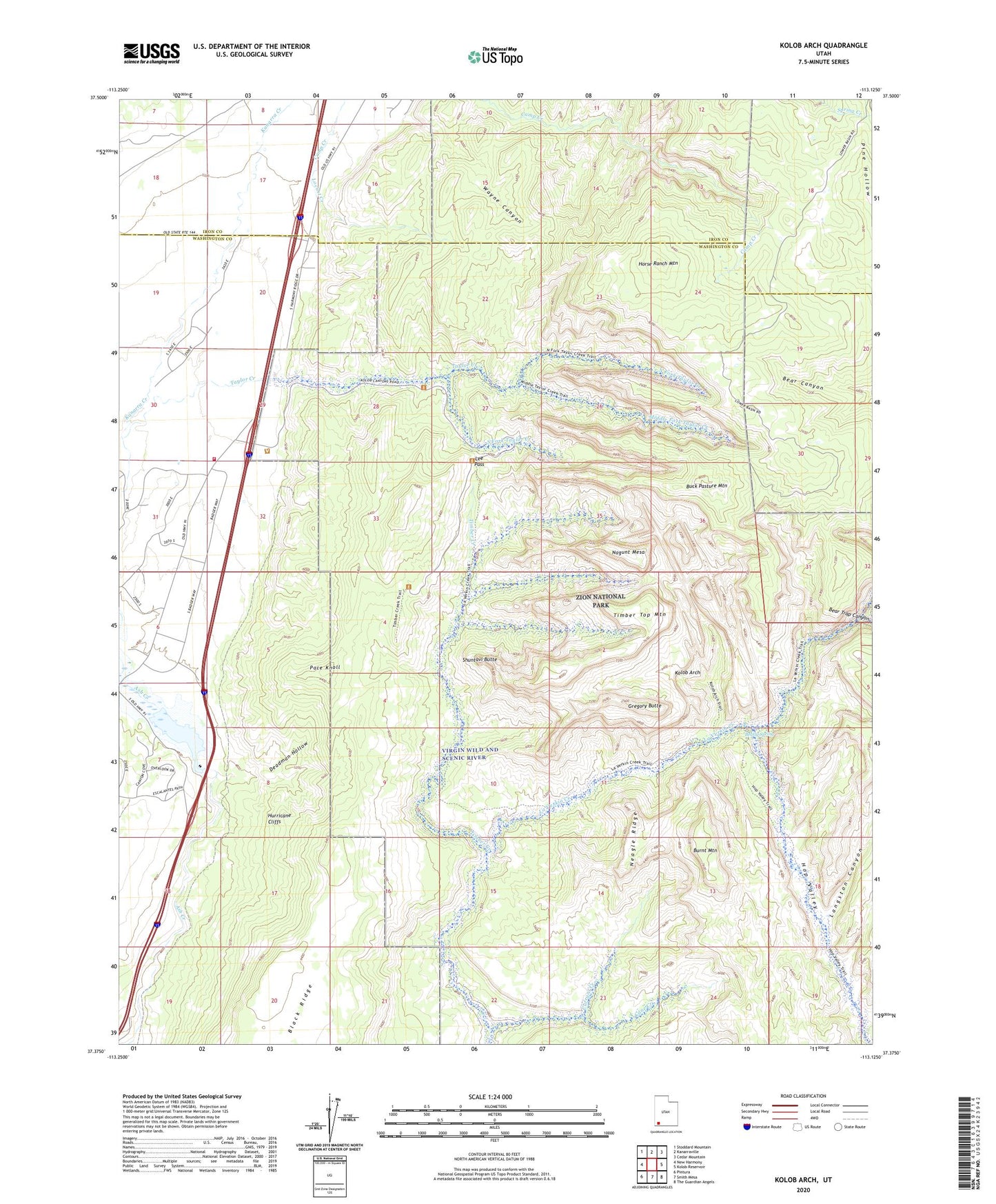
2023 topographic map quadrangle Kolob Arch in the state of Utah. Scale: 1:24000. Based on the newly updated USGS 7.5' US Topo map series, this map is in the following counties: Washington, Iron. The map contains contour data, water features, and other items you are used to seeing on USGS maps, but also has updated roads and other features. This is the next generation of topographic maps. Printed on high-quality waterproof paper with UV fade-resistant inks.
Quads adjacent to this one:
West: New Harmony
Northwest: Stoddard Mountain
North: Kanarraville
Northeast: Cedar Mountain
East: Kolob Reservoir
Southeast: The Guardian Angels
South: Smith Mesa
Southwest: Pintura
This map covers the same area as the classic USGS quad with code o37113d2.
Contains the following named places: Ash Creek Dam, Ash Creek Reservoir, Bear Trap Canyon, Beatty Point, Beatty Spring, Buck Pasture Mountain, Burnt Mountain, Camp Creek, Cane Creek, Currant Creek, Deadman Hollow, Death Point, Epsolon Mine, Fort Harmony Monument, Gregory Butte, Herbs Point, Hop Valley, Hop Valley Trail, Horse Ranch Mountain, Hurricane Cliffs, Kolob Arch, Kolob Arch Trail, Kolob Canyon Road Terminus Campground, Kolob Canyons Viewpoint, Kolob Canyons Visitor Center, La Verkin Creek Trail, Langston Canyon, Larson Cabin, Lee Pass, Locust Creek, Middle Fork Taylor Creek, Nagunt Mesa, Neagle Ridge, New Harmony Fire Station - Kolob Station, North Fork Taylor Creek, Old Fort Harmony, Pace Knoll, Paria Point, Shuntavi Butte, Smith Cabin, South Fork Taylor Creek, Stapley Point, Taylor Creek, Taylor Creek Wilderness, Timber Creek, Timber Top Mountain, Tucupit Point, Wayne Canyon