MyTopo
Emery East Utah US Topo Map
Couldn't load pickup availability
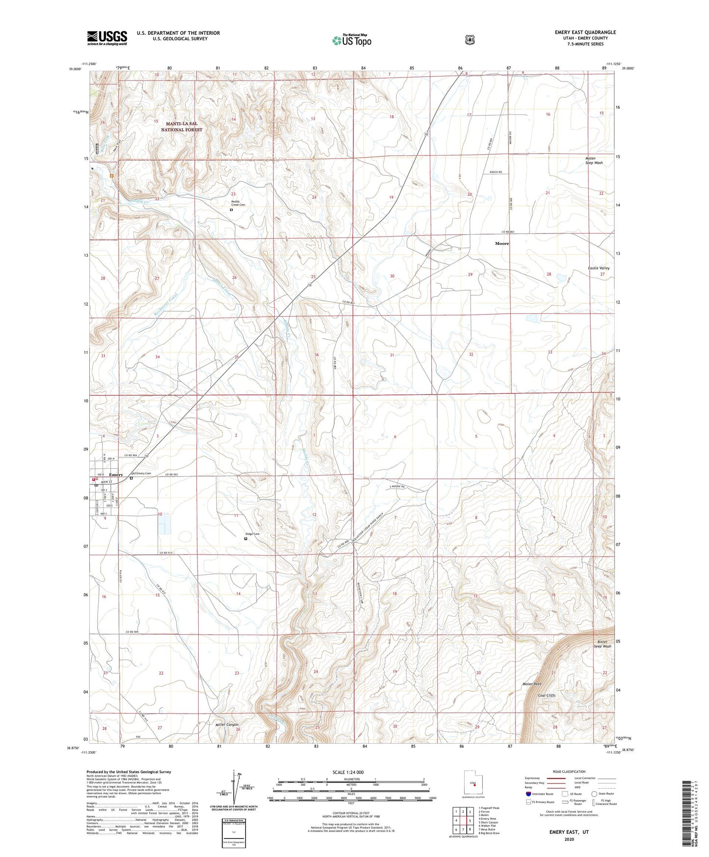
2020 topographic map quadrangle Emery East in the state of Utah. Scale: 1:24000. Based on the newly updated USGS 7.5' US Topo map series, this map is in the following counties: Emery. The map contains contour data, water features, and other items you are used to seeing on USGS maps, but also has updated roads and other features. This is the next generation of topographic maps. Printed on high-quality waterproof paper with UV fade-resistant inks.
Quads adjacent to this one:
West: Emery West
Northwest: Flagstaff Peak
North: Ferron
Northeast: Molen
East: Short Canyon
Southeast: Big Bend Draw
South: Mesa Butte
Southwest: Walker Flat
Contains the following named places: Castle Valley, Emery, Emery Canal, Emery Fire Department, Emery Post Office, Moore, Muddy Creek Cemetery, Old Emery Cemetery, Ridge Cemetery, Rochester Canal, The Church of Jesus Christ of Latter Day Saints, ZIP Code: 84522