MyTopo
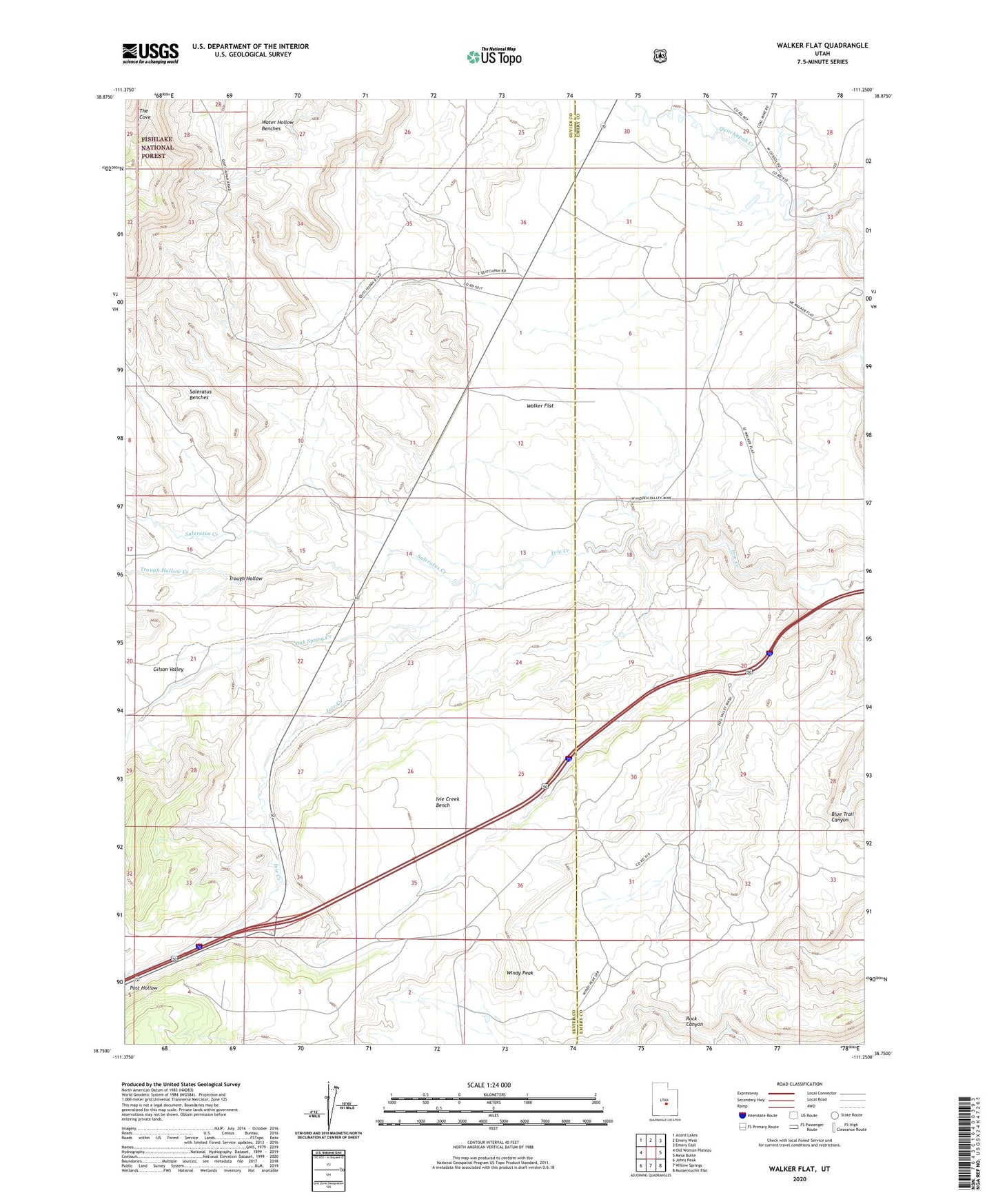
Walker Flat Utah US Topo Map
Couldn't load pickup availability
Also explore the Walker Flat Forest Service Topo of this same quad for updated USFS data
2023 topographic map quadrangle Walker Flat in the state of Utah. Scale: 1:24000. Based on the newly updated USGS 7.5' US Topo map series, this map is in the following counties: Sevier, Emery. The map contains contour data, water features, and other items you are used to seeing on USGS maps, but also has updated roads and other features. This is the next generation of topographic maps. Printed on high-quality waterproof paper with UV fade-resistant inks.
Quads adjacent to this one:
West: Old Woman Plateau
Northwest: Acord Lakes
North: Emery West
Northeast: Emery East
East: Mesa Butte
Southeast: Mussentuchit Flat
South: Willow Springs
Southwest: Johns Peak
This map covers the same area as the classic USGS quad with code o38111g3.
Contains the following named places: Browning Mine, Christiansen Wash, Coal Wash, Dog Valley Mine, Dog Valley Wash, Gilson Valley, Ivie Creek Bench, Jensen Place, Oak Spring Creek, Peacocks Place, Post Hollow, Saleratus Benches, Saleratus Creek, Trough Hollow, Trough Hollow Creek, Walker Flat, Windy Peak