MyTopo
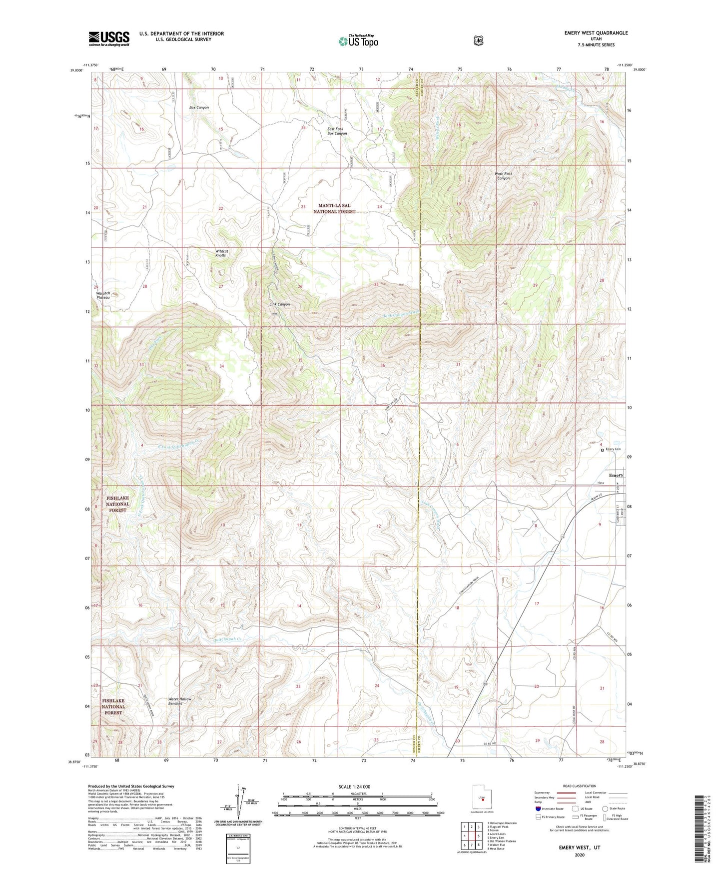
Emery West Utah US Topo Map
Couldn't load pickup availability
Also explore the Emery West Forest Service Topo of this same quad for updated USFS data
2023 topographic map quadrangle Emery West in the state of Utah. Scale: 1:24000. Based on the newly updated USGS 7.5' US Topo map series, this map is in the following counties: Sevier, Emery. The map contains contour data, water features, and other items you are used to seeing on USGS maps, but also has updated roads and other features. This is the next generation of topographic maps. Printed on high-quality waterproof paper with UV fade-resistant inks.
Quads adjacent to this one:
West: Acord Lakes
Northwest: Heliotrope Mountain
North: Flagstaff Peak
Northeast: Ferron
East: Emery East
Southeast: Mesa Butte
South: Walker Flat
Southwest: Old Woman Plateau
This map covers the same area as the classic USGS quad with code o38111h3.
Contains the following named places: Dry Fork, East Fork Quitchupah Creek, Emery Cemetery, Lewis Ranch, Link Canyon, Link Canyon Mine, Link Canyon Wash, North Fork Quitchupah Creek, Old Allridge Place, Quitchupah Ranch, The Pines, Town of Emery, Wash Rock Canyon, Water Hollow Benches, Wildcat Knolls