MyTopo
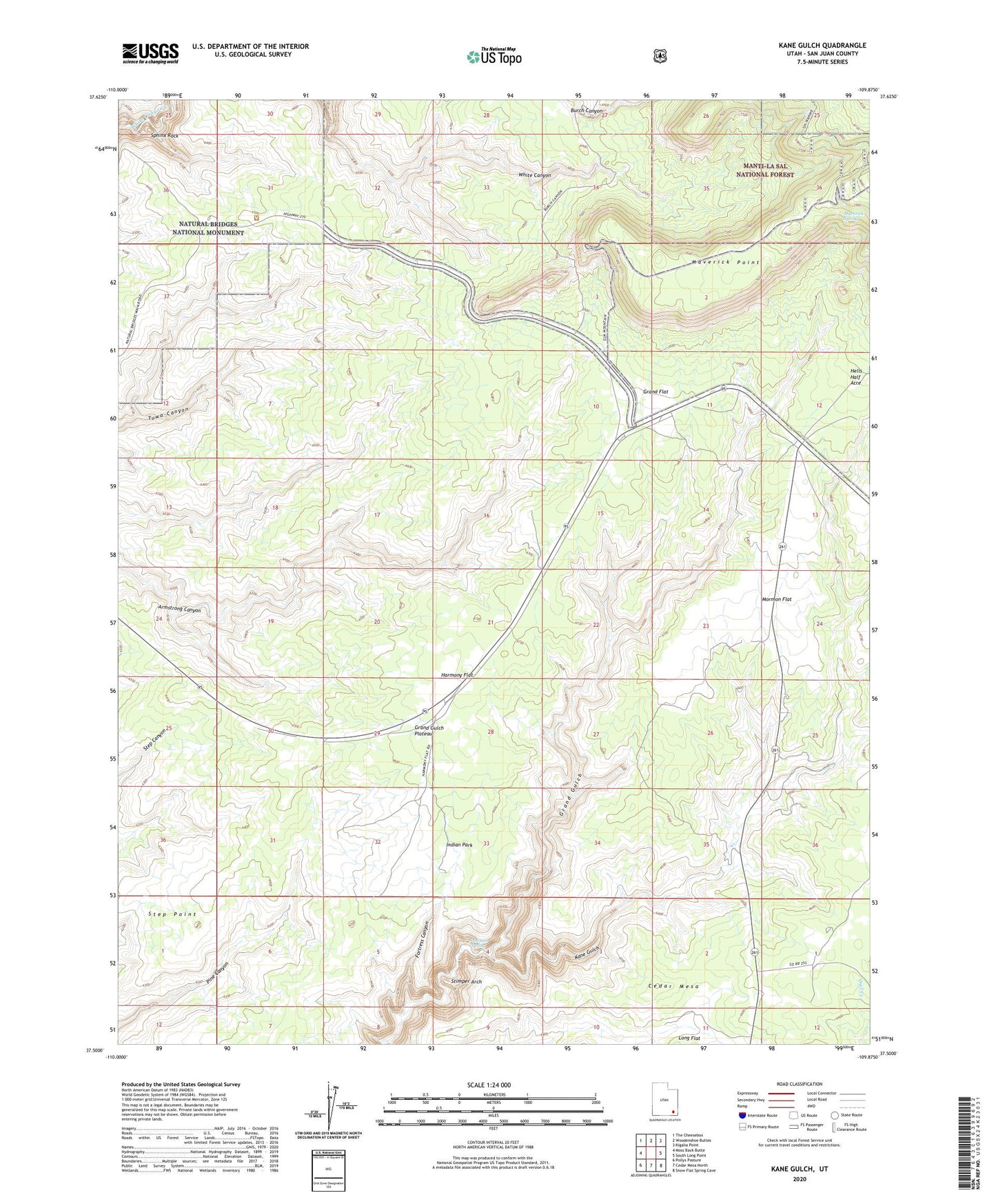
Kane Gulch Utah US Topo Map
Couldn't load pickup availability
Also explore the Kane Gulch Forest Service Topo of this same quad for updated USFS data
2023 topographic map quadrangle Kane Gulch in the state of Utah. Scale: 1:24000. Based on the newly updated USGS 7.5' US Topo map series, this map is in the following counties: San Juan. The map contains contour data, water features, and other items you are used to seeing on USGS maps, but also has updated roads and other features. This is the next generation of topographic maps. Printed on high-quality waterproof paper with UV fade-resistant inks.
Quads adjacent to this one:
West: Moss Back Butte
Northwest: The Cheesebox
North: Woodenshoe Buttes
Northeast: Kigalia Point
East: South Long Point
Southeast: Snow Flat Spring Cave
South: Cedar Mesa North
Southwest: Pollys Pasture
This map covers the same area as the classic USGS quad with code o37109e8.
Contains the following named places: Blanding Division, Fortress Canyon, Grand Flat, Grand Gulch Ranger Station, Harmony Flat, Hells Half Acre, Hole in the Rock Trail, Indian Park, Junction Spring, Kane Gulch, Kane Gulch Ranger Station, Kane Gulch Trailhead, Maverick Point, Maverick Spring, Monument Valley Overlook, Mormon Flat, Natural Bridges National Monument Campground, Natural Bridges National Monument Visitor Center, Natural Bridges Recreation Site, Photovoltaic Array, Sphinx Rock, Step Point, Stimper Arch