MyTopo
Moss Back Butte Utah US Topo Map
Couldn't load pickup availability
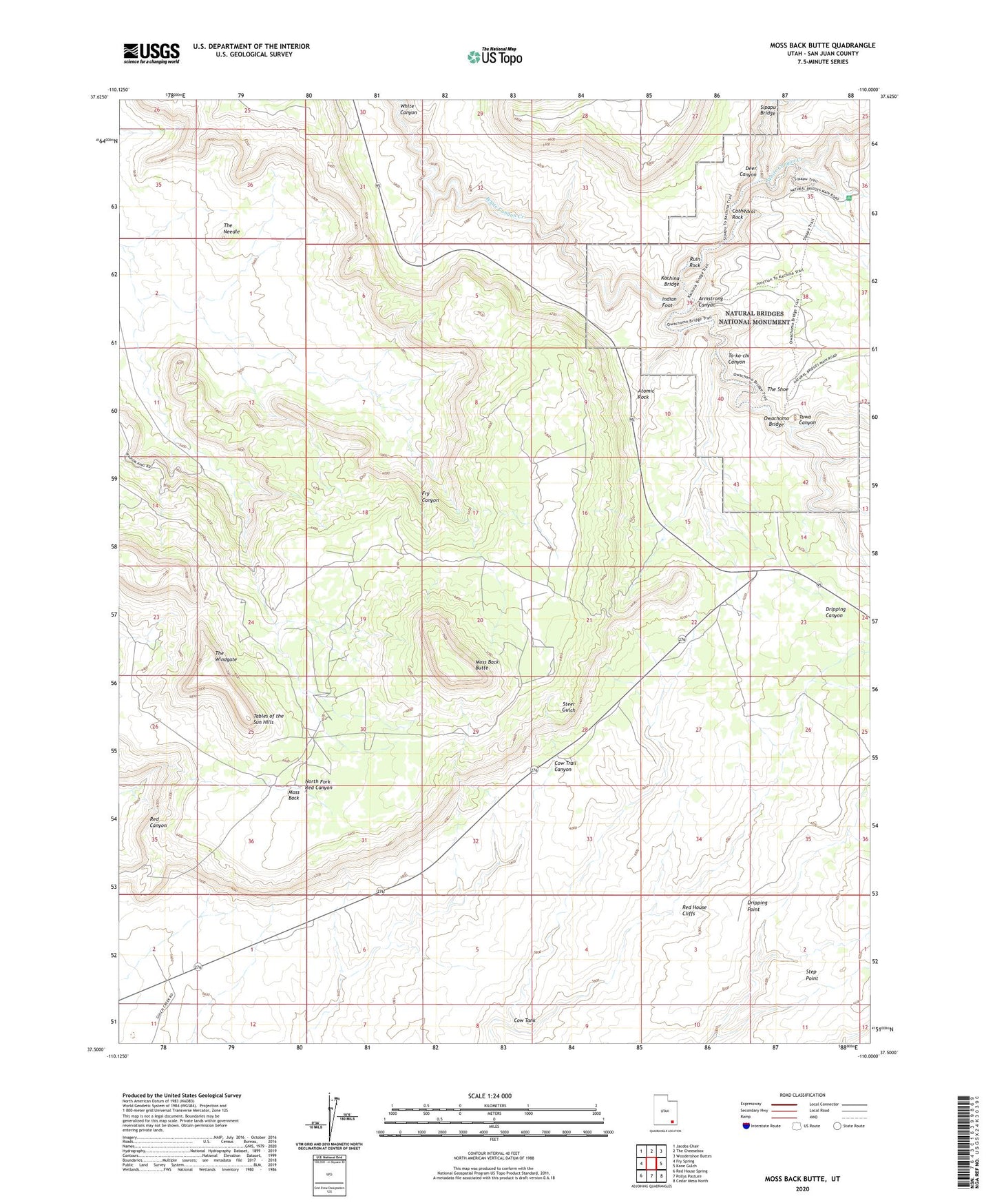
2023 topographic map quadrangle Moss Back Butte in the state of Utah. Scale: 1:24000. Based on the newly updated USGS 7.5' US Topo map series, this map is in the following counties: San Juan. The map contains contour data, water features, and other items you are used to seeing on USGS maps, but also has updated roads and other features. This is the next generation of topographic maps. Printed on high-quality waterproof paper with UV fade-resistant inks.
Quads adjacent to this one:
West: Fry Spring
Northwest: Jacobs Chair
North: The Cheesebox
Northeast: Woodenshoe Buttes
East: Kane Gulch
Southeast: Cedar Mesa North
South: Pollys Pasture
Southwest: Red House Spring
This map covers the same area as the classic USGS quad with code o37110e1.
Contains the following named places: Armstrong Canyon, Atomic Rock, Bridge View, Cathedral Rock, Cow Tank, Deer Canyon, Dripping Point, Fry Mesa, Indian Foot, Kachina Bridge, Moss Back, Moss Back Butte, Natural Bridges National Monument, Natural Bridges National Monument Picnic Area, Owachomo Bridge, Ruin Rock, Sipapu Bridge, Tables of the Sun, The Needle, The Shoe, The Windgate, To-ko-chi Canyon, Tuwa Canyon